Showing posts with label Wilderness. Show all posts

Saturday, May 4, 2013

Insect Repellants for Hiking And Backpacking

You need to evaluate where you are going.  What is the environment you are going to be visiting.  The insects you will experience will be very different on the windswept mountainside of the Presidentials in New Hampshire, vs. the open tundra of Denali National Park in Alaska.

If you are going to be visiting an area that is famous for biting insects, you need to come prepared.  Remember, everything is tied together in a big circle of life.  In the extreme northern climates the clouds of summertime mosquitoes feed the millions of birds that nest there.  Without them, the birds would starve.  In the deep south, the mosquito larvae feed countless insects, crustaceans, and fish.  In temperate climates, biting insects peak in the spring and fall, once again to feed the thousands of migrating birds.  Insects usually have a peak time in each area, be aware of these times is one of the first steps in not getting eaten alive.

Have you ever been in the forest and though that every mosquito within miles has descended upon you?  You may be correct!  Mosquitoes and other biting insects find their prey by sensing carbon dioxide.  As air breathing mammals, we give off large amounts of carbon dioxide not just by breathing, but through our skin, and blood thirsty mosquitoes have been equipped to sense this release from miles away.  This is where insect repellant comes in.

DEET, or N-diethyl-meta-toluamide is the active ingredient in most insect repellants, and comes in a variety of concentrations from as low as 4% to 100%.  DEET masks our release of carbon dioxide which makes us harder to detect by biting insects.  When we cover ourselves in repellant, we literally don't smell appealing to biting insects.

DEET based repellants come in liquid form, creams, lotions, pumps, and aerosol sprays.  Generally anything below 20% DEET content should be avoided for anything more than a backyard barbeque.  Conversely, high concentrations of DEET can also cause problems.  In excess of 35% can cause rashes.  Heavy use of concentrations in excess of 80% have been linked to short term schizophrenia, while behavior will return to normal after use is discontinued.  Many people have noticed becoming irritable after extended use of high concentrations of DEET based repellants.  Almost the entire population will find, that DEET based repellants are the best and safest choice of repellant they can use.

You may have heard about Avon's Skin So Soft.  Avon's Skin So Soft is a skin care product that is used as a moisturizer.  Many people swear by it as a mosquito repellant, and some non-scientific testing has indicated that it is pretty effective.  Avon has never, and will never advertise Skin So Soft as an insect repellant.  The lengthy and costly testing that goes into certifying a product is more than Avon wants to spend, and it moves away from the real features of the product.  Avon Skin So Soft only seems to work against mosquitoes, and not other members of the biting hordes.
Some real backcountry folks use kerosene, which is what was used long before the petrochemical industry gave us DEET or other repellant products.  Although kerosene is effective, it is damaging to clothing and skin, and is flammable.  I sure wouldn't want to be around the campfire after slapping some kerosene around the back of the neck and on the arms to keep the bugs away!

If you have ever felt that you are the most appetizing item on the face of the earth to insects, or conversely insects don't seem to be interested in you at all, there is some truth to this also.  Recently scientists have discovered that mosquitoes will select healthier people over sick people when selecting who to bite.  They don't understand exactly why, but speculate that our chemical signature, what the insect "smells," is different depending on our condition.  One does not have to be unhealthy to be lucky around flying insects.

When we swell up and itch from an insect bite it is because we are having an allergic reaction.  The insects fluids are injected into our skin and our bodies treat it as an immune reaction, and the bodies extreme reaction causes the bump, itch, and the redness around an insect bite.  A very lucky few, about 1% of the population do not have this reaction, and are not effected by insect bites.  The body has either built a tolerance up for the chemicals injected in an insect bite, or does not recognize them as a threat.

No Deet Products

One of the best non-deet products out on the market is from a friend of mine . His companies names is 45ºN 68ºW
The 45ºN 68ºWTM Insect Repellent Product is formulated with natural pharmaceutical grade oils of organic origin. These botanical oils have been used over thousands of years and are deemed to be safe and effective against numerous insects including various species of mosquitoes (some may carry West Nile Virus), flies, gnats, black flies, ticks, mites, and other arthropods.

Our natural insect repellent products (including insect repellent with 39% active ingredients) have undergone rigorous testing including evaluation in controlled studies with human subjects (n=5) for repellency to black salt marsh mosquitoes (Ochlerotatus taeniorhynchus Wiedemann), in the Everglades National Park, FL.


Natural Insect Repellent
•Personal Protection
◦Natural Insect Repellent 4 oz – single and multi-packs◦Natural Insect Repellent Family & Refill packs (coming soon)
Main attributes of the product:

• Promotes healthier lifestyle by allowing individuals to spend uninterrupted time outdoors.
• Creates awareness of our natural surroundings by allowing you to venture in the outdoors.
• Produced using natural pharmaceutical grade products of organic origin.
• Active ingredients include Neem, Lemon Eucalyptus and other essential organic oils.
• Proven to works against numerous insects including flies, gnats, mites, ticks, no see ums, mosquitoes etc.
• Does not contain N,N-Diethyl-meta-toluamide, abbreviated as DEET.
• Aromatherapeutic: Refreshing and energizing aroma on a hot hiking day.
• Developed and Manufactured in USA using mostly locally sourced herbals
• Environmentally responsible packaging.
To Order and read up more on this Non-Deet Product... http://45n68w.com/

Tuesday, November 20, 2012

Hike To Indian Flats Falls In GSMNP

Trailhead of Middle Prong Trail the way to Indian Flats Falls

A beautiful hike that follows Middle Prong Creek

This is a really cool water slide to go down in the summertime

Trail bridge going over a small creek

Very old fire place out in the middle of no where

A small group of butterflies

Mother natures art work deep in the woods ..... so beautiful

Old service road bridge across the creek

Almost to Indian Falls

Indian Falls Waterfall ... 3 waterfalls in one

Second falls down from Indian Flats

I love waterfall hikes so much

This was spooky a rock that spelled out my intials in moss ...... M G

Tuesday, September 4, 2012

List Of Long Distance Hiking Trails

Trails

This is a list of long distance trails in the US that are at least 100 miles in length and are primarily footpaths. Most of these trails are maintained by hiking clubs and outdoor recreational organizations. Please consider joining these organizations, becoming a trail maintenance volunteer, making a donation, or purchasing merchandise from their web site stores. These are all great trails. so get out there and hike them.

Appalachian Trail
As probably the best known long distance trail in the US, the Appalachian trail spans 2,181 miles from Maine to Georgia. Many local trail organizations contribute time and effort to maintaining sections of the trail.

Arizona Trail
The Arizona Trail is a primitive long distance trail, nearly 800 miles long, that traverses the state of Arizona from Mexico to Utah. The rail is broken into 43 sections that are 11 to 35 miles in length.

Benton MacKaye Trail
The Benton MacKaye Trail runs through the Appalachian Mountains of the southeast US for nearly 300 miles and passes through some of the most remote backcountry of Georgia, Tennessee and North Carolina.

Buckeye Trail
The Buckeye Trail forms a circuit around the state of Ohio and is neat 1,444 miles in length. There are 26 section to the Buckeye trail each named after a town or trail feature.

Cohos Trail
The Cohos Trail is a 162 mile trail in northern New Hampshire that stretches across the state's most remote and unpopulated terrain.

Colorado Trail
Stretching almost 500 miles from Denver to Durango, the Colorado Trail travels through the spectacular Colorado Rocky Mountains amongst peaks with lakes, creeks and diverse ecosystems. Trail users experience six wilderness areas and eight mountain ranges topping out at 13,334 feet.

Continental Divide Trail

The Continental Divide Trail links Mexico to Canada, passing through the states of Montana, Wyoming, Colorado and New Mexico. At this time, the CDT is not yet completed although significant portions have been completed in all 4 states. The Continental Divide separates the rivers and streams that flow east to the Atlantic Ocean from those that flow west to the Pacific.

Finger Lakes Trail
The Finger Lakes Trail is 562 miles long and connects the Catskills with the Allegheny Mountains passing through remote sections of New York State.

Florida Trail
The Florida Trail stretches the length of the State of Florida for nearly 1,400 miles. Portions of the trail that cross private land can only be hiked if you are a member of the Florida Trail Association, so join now.

Foothills Trail
The Foothills Trail is a 76 mile woodland path along the Blue Ridge Escarpment in northwestern South Carolina.

Horseshoe Trail
The Horse-Shoe Trail is a 140-mile hiking and equestrian trail that runs from Valley Forge to the Appalachian Trail in southeastern Pennsylvania. The trail runs roughly parallel to the I-76 turnpike from Harrisburg to Valley Forge.
  • Join the Horse-Shoe Trail Club
  • Guide to the Horse-Shoe Trail

Ice Age Trail
 The 1,000 mile Ice Age Trail is located entirely within the state of Wisconsin. The Trail goes through mixed forests, open prairies, marsh and wetland areas, along wide gravel rail-trails and established state park trails. It traverses farm fields, urban and residential areas, small communities and remote state and national forests.

John Muir Trail
The John Muir trail runs for 211 miles from Yosemite Valley to Mt. Whitney, in California. The trail is considered one of the most picturesque hikes in the US and trail elevation ranges from 8,000 feet to nearly 15,000 feet. Wilderness Permits are required to camp on the trail.

Long Path
the Long Path is a 326 mile hiking trail extending from the George Washington Bridge, north to John Boyd Thacher Park near Albany. Future plans are to extend the trail to the Mohawk River and eventually into the Adirondaks.

Long Trail
Built by the Green Mountain Club between 1910 and 1930, the 272 mile Long Trail is the oldest long-distance trail in the United States. The Long Trail follows the main ridge of the Green Mountains from the Massachusetts-Vermont line to the Canadian border as it crosses Vermont's highest peaks. It was the inspiration for the Appalachian Trail, which coincides with it for one hundred miles in the southern third of the state.

Mason Dixon Trail
The 193 mile long Mason-Dixon Trail starts on the Appalachian trial at Whiskey Spings in Cumberland County, PA and runs to Chadds Ford, PA, on the banks of the Brandywine River. The Mason Dixon trail system membership is aging and seeks new members and volunteers to help preserve this historic trail.

Metacomet-Monadnock Trail
The Metacomet-Monadnock Trial is 114 miles long and runs from the Connecticut-Massachusetts state line to Mt. Monadnock in New Hampshire. The M-M trail passes through  the most beautiful sections of Western Massachusetts and is maintains by the Western Massachusetts Chapter of the Appalachian Mountain Club.

Monadnock-Sunapee Greenway
The Monadnock-Sunapee Greenway is a 50 mile hiking trail linking Mount Monadnock with Mount Sunapee in southwestern New Hampshire. The trail winds along the Monadnock Highlands that separate the Connecticut and Merrimack River watersheds.

Mountains to Sea Trail
North Carolina's Mountains to Sea trail is a 935 miles long, stretching from Clingman's Dome in the Great Smokey Mountains National Park to Jockey's Ridge State Park on the Atlantic Ocean. The entire end-to-end trail is not completed, although significant portions are finished. .


North Country Trail
The North Country Trial is nearly 4,600 miles long and passes through 7 northern states including New York, Pennsylvania, Ohio, Michigan, Wisconsin,
  • Join the North Country Trail Association
  • Purchase maps and guides

Ouachita Trail
 The Ouachita Trail stretches 223 miles through the beautiful Ouachita Mountains of Arkansas and Oklahoma.

Ozark Highlands Trail
The Ozark Highlands Trail is 165 miles long and is located in northwest Arkansas.

The Ozark Trail
The Ozark Trail is 350 miles of trail that wind through the Missouri Ozarks, part of a 25-year-old concept to run a trail from St. Louis to the Arkansas border and eventually connect with the Ozark Highland Trail in Arkansas to create a 700-mile through-trail.

Pacific Crest Trail
The Pacific Crest Trail is 2,650 miles long and zigzags its way from Mexico to Canada through California, Oregon and Washington. The trail passes through a wide variety of habitats including desert, old-growth forest and alpine back country.

Pacific Northwest Trail
The Pacific Northwest Trail is 1,200 miles long and runs from the Continental divide to the Pacific, passing through the Rocky Mountains, the Selkirk Mountains, Pasayten Wilderness, the North Cascades, the Olympic Mountains and the Wilderness Coast.

Midstate Trail of Pennsylvania
The 285 mile Midstate Trail is the longest continuous footpath in Pennsylvania running from the Mason Dixon Line to the Pennsylvania/New York State border. The trail features spectacular vista from mountaintops and the remoteness of wild forests and streams.

Superior Hiking Trail
The Superior Hiking Trail is a 205 mile long footpath that follows the rocky ridgeline above Lake Superior in northeastern Minnesota from Two Harbors to the Canadian border. The trail has trailheads with parking lots every 5 to 10 miles, making it ideal for section hikers.


Tahoe Rim Trail
The Tahoe Rim Trail is a 165 mile loop around Lake Tahoe. About 50 miles of the trail overlap with the Pacific Crest Trail.

Tuscarora Trail
The Tuscarora Trail is a 248-mile route that parallels the Appalachian Trail in northern Virginia, West Virginia, Maryland and Pennsylvania. 


Sunday, July 1, 2012

The Smoky Mountain Hiking Blog: Ultimate Hike on the Foothills Trail

The Smoky Mountain Hiking Blog: Ultimate Hike on the Foothills Trail: Start training right now for the Ultimate Hike on the Foothills Trail this October. The reason you may want to start your training so soon is because the hike travels 28.3 miles - in just one day!

The hike is sponsored by Ultimate Hike, an organization that is helping to raise money towards finding a cure for children's cancer, the #1 cause of death by disease in children.

If you happen to live in the Chattanooga area, Outdoor Chattanooga will be holding an Information Meeting on July 17th, at 6:30 p.m., at their Coolidge Park facility on 200 River Street. The public is invited to learn how they can train for the event, which happens on Saturday, Oct. 13, 2012. Leah Bartlett, from Cure Search, will be there to answer questions about training, fundraising and the hike experience. No pre-registration is required for the meeting. Additional information meetings will be held on July 18 at Rock/Creek and July 20 at Cloudland Canyon State Park.

Friday, June 29, 2012

Wildfires in Southern Appalachians Grow; More Trai...

The Smoky Mountain Hiking Blog: Wildfires in Southern Appalachians Grow; More Trai...: As of this morning there are now 47 uncontained large wildfires burning nationwide, up 6 from yesterday. Below is a run down of the three fires burning in the Southern Appalachians:

The Neighbor Mountain Fire in Shenandoah National Park has grown to 800 acres as of yesterday afternoon. The fire is burning north of Route 211 and west of Skyline Drive. Seventy-three firefighters and overhead staff are currently assigned. Heat and rough terrain are expected to slow suppression efforts over the next several days, while the estimated date for full containment is July 15th. The following trails and facilities are closed:

* Appalachian Trail between Elkwallow and Beahms Gap
* Jeremys Run Trail
* Neighbor Mountain Trail
* Knob Mountain Trail
* Knob Mountain Cutoff
* Jeremys Run Overlook
* Byrds Nest #4 shelter

Just north of Shenandoah is the Point 2 Wildland Fire, which has grown to 353 acres as of last night. The fire is located on Massanutten Mountain between Veach Gap and Sherman Gap in the counties of Warren and Shenandoah, in the George Washington & Jefferson National Forests. The fire is still only 5% contained, but 105 fire-fighting personnel are on hand. The following trails are closed until further notice:

* Massanutten National Recreation Trail (#408) from Shawl Gap to Veach Gap
* Tuscarora Trail (#405.1) is closed from Shawl Gap to Panhandle Road (SR 613)
* Sherman Gap Trail (#403)
* Veach Gap Trail (#484)
* The Little Crease Trail Shelter is also closed

US Forest Service officials in the Cherokee National Forest say a wildfire has burned nearly two hundred acres on the Ocoee Ranger District in Polk County since Monday. The fire is located off U.S. Highway 64 near Goforth Creek in steep rugged terrain. There are currently no threats to any structures.

Approximately 50 personnel from the U.S. Forest Service, Tennessee Division of Forestry, and various volunteer fire departments are working on containment lines. The extremely steep terrain combined with very hot and dry conditions is making firefighting efforts difficult.

Ocoee Acting District Ranger Andy Gaston said, “Motorist should exercise caution when traveling along Highway 64. Firefighting crews and equipment as well as smoke will be in the area and may cause traffic delays. In addition, the Goforth Creek parking area will be used for firefighting access and equipment parking and is closed to public use.”

Gaston also noted that, “There have been hot and dry conditions over the last few days and this pattern will continue into the weekend and the 4th of July week. National Forest visitors need to be very careful with fire and ensure that campfires are out and cold before leaving.”

Friday, February 17, 2012

5 Different Types of Forest In The GSMNP

Five forest types dominate the Great Smoky Mountains. Together these forests sport more than 130 species of trees, and 4,000 other plant species. They represent all the major forest types along eastern North America. As elevation increases within the park, temperature decreases and precipitation increases. Each 1,000 feet of elevation gained is the equivalent of moving 250 miles north. The additional precipitation classifies small sections of the Park as a rainforest. All five types can be seen at once from Campbell Overlook, two miles south of the Sugarlands Visitor Center on Newfound Gap Road (US 441).

The spruce-fir forest caps the Park's highest elevations. Most areas above 4,500 feet support some elements of this forest. It is best developed above 5,500 feet. In terms of climate the spruce-fir forest relates to areas such as Maine, and Quebec, Canada. The main components of the spruce-fir forest are red spruce and Frasier fir. Other important species include yellow birch, mountain-ash, hobblebush, and blackberries. The balsam woolly adelgid killed 95% of the Frasier firs over the past decade. Accidentally introduced from Europe, this tragedy threatens the fate of the entire forest type. The Park sprays to control the insect, but this is a labor consuming process that needs to saturate each tree. Environmental pressures, including acidic deposition and ozone present further threats.

A northern hardwood forest dominates the middle to upper elevations from 3,500- 5,000 feet. It mixes with many species from other forest types, but is characterized by sugar maple, American beech, and yellow birch. These forests resemble those throughout much of New England, New York, Pennsylvania, and southern Ontario. The northern hardwood forest, specifically sugar maples, produces the most brilliant fall color.

Drier ridges in and around the Park hold a pine-oak forest. Despite plentiful amounts of rain, these excessively drained slopes dry out often, and fire is a regular part of these forest communities. In late 1996, the Park began controlled burning to prevent unintentional fires from threatening lives and property. This also insures natural regeneration of species requiring fire for propagation. Major species include red, scarlet, black and chestnut oaks, along with table mountain, pitch, and white pines. Some areas also have hickories.

A hemlock forest often grows along streambanks. Water temperatures remain cold year- round, and this cools and dampens the air. Hemlocks survive better in these conditions than any other species. Hemlocks dominate streamsides throughout the Appalachians. An insect, the hemlock woolly adelgid is moving south and west. It threatens every hemlock in the eastern united States.

The cove hardwood forest lines the valleys throughout the Park. It is the Smokies most diverse ecosystem. Important species include, tulip poplar, American basswood, red maple, sweet gum, yellow buckeye, black birch, and dogwood. This lush, diverse forest enjoys warm temperatures, a long growing season, and plentiful rainfall.

Other Trees

Sixty years ago, the most common Park tree was American Chestnut. About 30% of the Park was chestnut forest. Due to a disease, chestnut blight, every adult chestnut in the eastern United States died. Loss of the chestnut heavily impacted animals depending on the nuts for winter fat. Scientists continue to work search for hybrid chestnut species that can resist this disease.

Black walnuts are common near homesites. Often planted in yards, walnut wood was valuable, and the nuts made good food.

Black cherry is another valuable wood and food source. The cherries are a favorite of bears when they ripen in August. Cherry trees are often damaged by climbing bears.

Tennessee's state tree, tulip poplar, is abundant in the Park. Builders favor it for cabins. It grows long and straight, striving for the sun without pause.
 

Wednesday, January 18, 2012

Loop Hikes In The Great Smoky Mountains ( GSMNP )

Tennessee Side Loop Hikes
Cucumber Gap / Little River Trail
Trailhead: Elkmont
Length: 5.6 miles
Trail Features: Historic Elkmont cottages, wildflowers, hike along stream
Finley Cane / Bote Mountain / Lead Cove
Trailhead: Laurel Creek Road (about 5.5 miles from the Townsend "Y"
Length: 7 miles
Trail Features: Quiet walk in woods, old homestead sites and sporadic views of surrounding mountains

Rich Mountain Loop
Trailhead: Main Cades Cove parking area
Length: 8.5 miles
Trail Features: John Oliver cabin, wildflowers, sporadic views of Cades Cove and Tuckaleechee Cove

Deep Creek/Indian Creek/Deep Creek Loop Trailhead: Deep Creek
Length: 4.6 miles
Trail Features: Waterfalls and wildflowers
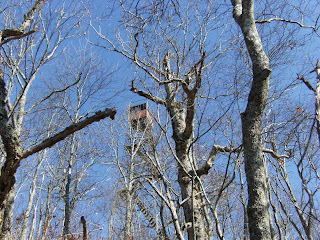
Mt. Cammerer Fire Tower

Smokemont Loop Trail / Bradley Fork
Trailhead: Smokemont Campground
Length: 6.2 miles
Trail Features: Wildflowers and a walk along the Bradley Fork

Russell Field / Spence Field
Trailhead: Anthony Creek Trailhead in the Cades Cove Picnic Area Length: 13.3 miles
Trail Features: Panoramic views from Spence Field, abundant mountain laurel

Wet Bottom / Cooper Road / Hatcher Mountain / Abrams Falls
Trailhead: Cades Cove Visitor Center
Length: 13.4 miles
Trail Features: Abrams Falls, solitude (other than the section to the falls)

Rainbow Falls / Mt. LeConte / Bullhead
Trailhead: Cherokee Orchard Loop
Length: 14.1 miles
Trail Features: Spectacular views from the summit of Mt. LeConte, Rainbow Falls highest falls in park

Lower Mt. Cammerer /Appalachian Trail / Low Gap
Trailhead: Cosby Campground
Length: 15.5 miles
Trail Features: Spectacular views, Historic Mt. Cammerer Fire Tower


North Carolina Side Loop Hikes

Goldmine Loop Trail
Trailhead: Lakeshore Drive Tunnel
Length: 3.8 miles
Trail Features: Fontana Lake, remains of an old home site
Twentymile Trail / Twentymile Loop / Wolf Ridge
Trailhead: Twentmile (west of Fontana Village)
Length: 7.6 miles
Trail Features: Mountain streams and a small waterfall

Caldwell Fork / Boogerman Trail
Trailhead: Cataloochee Campground
Length: 7.4 miles
Trail Features: Old growth forest, picturesque streams and falls, and the remains of early settler's home sites
Shuckstack Fire Tower

Cooper Creek / Deeplow Gap / Thomas Divide / Mingus Creek
Trailhead: Cooper Creek Trailhead (north of Ela, NC)
Length: 11.1 miles
Trail Features: Waterfalls and sporadic views of surrounding mountains

Appalachian Trail / Shuckstack / Lost Cove / Lakeshore Trail
Trailhead: Fontana Dam
Length: 12 miles
Trail Features: Shuckstack Fire Tower, spectacular views of Fontana Lake, remnants of old home sites

Hemphill Bald / Caldwell Fork / Rough Fork
Trailhead: Polls Gap (near Balsam Mountain Campground)
Length: 13.7 miles
Trail Features: Outstanding views of the Cataloochee Valley

Facts about The Great Smoky Mountain National Park ( GSMNP )

Formed roughly 200-300 million years ago, the Great Smoky Mountains are among the oldest mountains in the world. Today, the park bearing the name of these mountains encompasses more than 541,000 acres (more than 800 + square miles). Just over half of this landmass lies within the state of North Carolina, with the rest in Tennessee.
The Great Smoky Mountains National Park receives more than 9.5 million visitors a year, making it the most visited national park in the country. The Grand Canyon, the second most visited national park, receives roughly 4.4 million visitors per year!

June, July, August and October are the most popular months for visitors. The park sees more than a million visitors during each of these months.
Although the Smokies may seem overcrowded with these kinds of numbers, it's still easy to escape civilization. The park boasts more than 800 miles of trails, including roughly 74.5 miles of the Appalachian Trail which runs along the crest of the Smokies. Yes, there are a few trails with extreme crowds during the summer, but these are usually the shorter trails near Gatlinburg, Cades Cove or along Newfound Gap Road. Go to the more remote sections of the park, or take a longer trail, and you're likely to find virtual solitude.

Hikers will find that trails in the Smokies offer a great amount of diversity. For one, elevation in the park ranges from 840 feet at the mouth of Abrams Creek on the western edge of the park, to 6643 feet at the summit of Clingmans Dome. There are also more than 2100 miles of streams in the park, making for numerous fishing opportunities, picnic spots, or even a swimming hole during a hot summer afternoon.

The Smokies are home to more than 1600 species of flowering plants. During the spring, wildflowers explode during the brief window prior to trees leafing out and shading the forest floor (from about mid-April thru mid-May). During the early summer period (from about mid-June to mid-July), awesome displays of mountain laurel, rhododendron, flame azalea, and other heath family shrub flowers can be enjoyed, especially on the higher elevation balds. For Catawba rhododendron, take the relatively short hike to Andrews Bald. Although somewhat of a long trek, hikers going to Gregory Bald will be amply rewarded by the exceptional displays of flame azalea at the summit. Finally, Spence Field is by far the best place for mountain laurel.
 
There are 66 species of mammals, including black bears, elk, fox, bobcats, coyotes, and river otter that live within the park borders. Based on a study conducted in 2006, biologists estimate that approximately 1,500 black bears live in the park, a density of approximately two bears per square mile. This National Park link will provide you with a better understanding of bear behavior and what to do if you see one on the trail.
 
Additionally, there are over 245 varieties of birds, 83 native fish species, and more than 80 types of reptiles and amphibians (data is from the All Taxa Biodiversity Inventory).

Other key facts about Great Smoky Mountains National Park:
* Great Smoky Mountains National Park was established in 1934.

* The Great Smoky Mountains is one of the only major national parks that doesn't charge an entrance fee.
* There are three visitors centers located within the park: Sugarlands (Gatlinburg), Cades Cove, and Oconaluftee (Cherokee, NC).
* There are 10 campgrounds with a total of 1000 sites within the park boundaries. Additionally, there are more than 100 backcountry campsites, including shelters.

* The park maintains 78 historic structures located in five historic districts.

* The park was designated as an International Biosphere Reserve by the United Nations on October 26, 1976. It was also designated a World Heritage Site on December 6, 1983.

* In the Smokies, the average annual rainfall varies from approximately 55 inches in the valleys, to over 85 inches on some peaks, more than anywhere else in the country except the Pacific Northwest. During the wettest years, over eight feet of rain can fall in the high country.

Monday, December 12, 2011

How To Build A Survival Shelter

First of all, location is key. Aside from the normal criteria which includes avoiding low spots, steering clear of standing dead trees, etc….proximity to materials can save a lot of time and energy. Take the time to find a spot that feels right.

For construction, the first thing you’ll need to build a survival shelter is a strong ridegepole that is at least a little taller than you are with your arm stretched above your head. You’ll also need something for one end of the ridgepole to securely rest on—a stump, boulder, fork of a tree, some kind of prop. The other end rests on the ground. At the high end, the ridgepole should be at about hip height.

Once your ridgepole is in place, you’ll need ribbing. Lean the ribs against the ridgepole fairly close together leaving a door at the high end. Once ribs are in place, crawl inside feet first checking to see that you have a little room to move, but that it is still snug and cozy. If your survival shelter is too big, you will have trouble staying warm. Imagine you are making a sleeping bag out of natural materials!
debris hut

Next, add a layer of lattice, something to act as a net to hold debris in place when it is piled on next. Brush and twiggy branches may work well. The debris that you have available can help determine how small the spaces in your lattice can be.

The structure is now in place and it is time for the essential component of insulation. Of all the things you’ll learn about how to build a survival shelter, not having enough insulation on a cold night will teach you quickly what is required. Get ready to shuffle your feet or make yourself a rake and start gathering debris! For good insulation, you’ll want material that can trap air. Obviously, dry material is optimal. Pile on your leaves, ferns, grass, or other available debris.
Keep piling, keep piling, go for TWO FEET THICK or more if you might get rained on. Be sure to close up the door area so that you have just enough room to squeeze in without disturbing the structure. Crawl in to see how your cocoon feels. Finish up your insulation by adding some small branches that will hold the debris in case of wind, maintaining as much loft as possible.

Now that the outer layer is complete, it is time to stuff your primitive survival shelter with dry soft debris. If you only have wet leaves, use them anyway, you may get wet, but you can still be warm. Once your shelter is full of debris, wiggle in to compress a space for your body. Add more debris as needed, and don’t forget the foot area! Fill up the spaces if you are concerned about being cold. Before you crawl in for the night in your primitive shelter, gather a pile of leaves near the door so that you can close yourself in most of the way.

Tuesday, November 15, 2011

Tuesday, November 8, 2011

Approaching Wildlife While Hiking , Camping or Auto Touring

Most visitors understand that feeding wildlife is against the law, but many people do not realize that disturbing park wildlife is also a violation of federal regulations and can result in fines and arrest.
The laws protecting park wildlife are contained in the Code of Federal Regulations. It states that “Willfully approaching within 50 yards (150 feet), or any distance that disturbs or displaces bear or elk is prohibited." In addition, feeding, touching, teasing, frightening, or intentionally disturbing wildlife is prohibited.
As a rule of thumb, if you approach an animal so closely that it changes its behavior, you have approached too closely. Instead use binoculars, spotting scopes and cameras with telephoto lenses to enjoy wildlife. Watch for any modification in an animal's behavior that indicates that you have approached too closely. Move away from the animal until you reach a distance at which the animal feels comfortable once again and resumes whatever activity it was engaged in before you approached.
Never feed wildlife or bait animals for closer observation or photography. Feeding park wildlife usually guarantees its demise.
Viewing Tips
Viewing wildlife in the Smokies can be challenging because most of the park is covered by dense forest. Open areas like Cataloochee and Cades Cove offer some of the best opportunities to see white-tailed deer, black bear, raccoon, turkeys, woodchucks, and other animals. The narrow, winding road of Roaring Fork Motor Nature Trail encourages motorists to travel at a leisurely pace and sometimes yields sightings of bear and other wildlife. During winter wildlife is more visible because deciduous trees have lost their leaves.
Because many animals are most active at night, it can be advantageous to look for wildlife during morning and evening. It's also a good idea to carry binoculars. Some people like to sit quietly beside a trail to see what wildlife will come out of hiding. And don't forget to scan the trees—many animals spend their days among the branches.

Monday, October 31, 2011

Helpful Hints For Winter Hiking

Helpful Hints
        If this section is here for one reason it's to prove that much of what's required to be safe and have fun when out in the woods in winter is nothing more then common sense and more importantly, experience! When are you so cold that you should put on more clothes and when are you just a bit chilly and more clothes would only lead to sweating? No one, not even you can answer that until you have hiked up a trail in winter and stopped to put on more clothes only to have to stop again in 30 minutes because you were sweating profusely! So, all I'm saying is, take each of these "hints" as just that, a hint, a pointer to get you going in the right direction. Hopefully they'll help you become a learned, experienced winter hiker just a tad faster than you would without them.

Start Cold: Ok, I know this sounds foolish and it even sounds like it contradicts advice I've give elsewhere on this page but it's another lesson that took me a while to get down! I get to the trailhead, get out of the car, put on my boots, adjust my poles, grab my pack etc. etc. etc. By then I'm thinking its freezing cold out so I put on my jacket, or shell, or whatever and head up the trail. Almost without exception within 15 minutes I'm too warm and have to stop to take something off. Trouble is, if I stop that soon by the time I get the jacket off, put it in the pack and start out again, I'm chilly! And on it goes. So I've just learned that when I leave the car I put on what I think I'll need a good half hour down the trail. For me, if it's in the 10 - 20 degree range that's my zip turtle neck and maybe the vest. If it's near zero, the turtle neck and undoubtedly the vest. I will not put on more to start the hike unless the temp is zero or below as I've learned what's coming!

Stay Warm: No, this does not contradict the first "hint." Staying warm may sound obvious but I know how many times I was thinking, "Boy I'm getting cold," but kept going either hoping to warm up or just plain being lazy and not wanting to stop to put on more clothes. Trust me, it's much, much easier to stay warm than it is to get warm once you're cold. IF you're a bit too chilly either stop and take care of it or at the very least pick up the pace for a few minutes to see if that warms you up. If not, stop! As for the balance between this "hint" and the previous one, there's only one way for you to find the balance and that's for you to get out there and see how your body responds. I'm simply hoping to share a bit of personal experience to hopefully speed up your learning process a bit. It wont take long for you to realize that regulating your temperture is one of the biggest challenges and yet another of those things that can only be learned by doing.

Stay Dry: Another point that seems pretty obvious but I'm going to mention it anyway. That little bit of snow that falls on your shoulders as you duck under the tree, the dusting of snow on your mittens from grabbing that branch, all of it quickly melts and makes you very wet! It's very beneficial to make an effort to brush it off a.s.a.p before it melts. Simple? Yup! Worth it? Yup!
        Another area that the "stay dry" rule applies to is perspiration. It's common to hear or read how important it is for you to adjust your clothing to make sure that you never, never allow yourself to become damp or yikes, worse yet, wet from sweating! All I can say is that many years of winter hiking has taught me that the concept is sound, the application impossible for many of us! If I put 15 or 20 pounds on my back, snowshoes on my feet and then climb a moderately steep trail I am going to sweat big time! It can be 10 degrees and I'm wearing only a T Shirt and I WILL be dripping sweat! Many other's are the same way. So, be as careful as you can and certainly don't have on that huge down parka as you plod up the hill but you may just have to be realistic about it. Some people are going to sweat, that's all there is to it! Strip down as far as you can and make sure that you do have a dry layer to put on incase of emergency but there's not too much else you can do. That's why it's not uncommon in the dead of winter to see people hiking in shorts! I've seen it more than a few times!
        A pointer...I DID say to have something dry with you but don't make the mistake of being an hour into an 8 hour hike and being all sweaty and putting on your dry clothes. If you do that you no longer have the dry clothes! You just come to accept that when you stop for a break you're going to get cold faster than the person that is bone dry. What I do is to have a down jacket in my pack to pull out during breaks if needed but I try to not put on so much that I prevent my wet clothes from breathing and drying out. One thing that is very helpful is to anticipate the break coming and slow waaayyyy down for the last 10 or 15 minutes so that you stop perspiring and your clothes get a chance to dry a bit. Here's the big reason I love the newer synthetic fabrics. I can have a base layer that's more than damp and within 20 minutes of not sweating and the breeze blowing it's totally dry. I've tried many but so far the best that I've used is "Micronamics" by The North Face. Expensive? Yep, but it dries so much faster that I'll never use anything else. If you come across some other amazing secrets that help to keep you dry, please let me know!!

Gear Access: This may sound obvious or perhaps not necessary but the first time that your fingers are so cold that they won't seem to do what you're telling them to do and you're elbow deep in your pack searching for your dry mittens, you'll feel very differently about it! I make certain that things like extra mittens, a hat and the like are always in an outside pocket and ready to grab quickly. If the temps are very cold I'll take a pair of my heaviest, warmest mittens and stuff them, wrist end down, into the mesh side pockets of my pack. That way IF my hands get so cold that I can't seem to undo a zipper I can grab those mittens and stuff my hands into them until they warm up. When I use a pack that doesn't have lots of pockets I take things like mittens and put them all in a colored mesh stuff sack. Maybe something like mittens in yellow, hats in red, etc. That way when I have to get into the pack I can just search for "red" and not have to spend so long trying to find a couple of simple pieces of gear.
Dry Bag: This is something that most hikers do year round but in winter you'll really want to have some nice comfy, warm, dry clothes awaiting you back in your car! That way if you get wet from the elements or simply from perspiration you at least know that all you have to do is to make it back to the car and you'll be comfortable again. Even if your car has great heat, when it's 5 degrees out you will not want to be trying to dry out your wet clothes on the way home as you may be able to when the temperature is much higher!

Zipper Pulls: You'll find it extremely beneficial to attach some type of "zipper pull" to all zippers on your pack, clothing etc. You can purchase commercially made pulls or you can simply take a short (2 or 3 inches) piece of old boot lace, run it through the zipper and knot it. This makes it possible to find, grasp and pull the zippers without having to remove your mittens! A very handy thing when the temp is 10 below!

Warm Power: Warm Power? Ok, what I mean is if you're using batteries to power your camera, head lamp or anything else you'll find that keeping the batteries warm makes a huge difference in their performance. When using my digital camera I keep one set of batteries in the camera and another set in a pocket as close to my body as possible. That way they are warm and ready to use if needed. Another pointer...lithium batteries function in much lower temperatures than other common battery types.

Practice: Trust me it's much better to find out in the warmth of your home that your shell doesn't fit over your insulating layer and many similiar lessons. Things like putting on your snowshoes with mittens on can be quite tricky until you've done it a few times. Sooo, practice at home!

Friday, October 28, 2011

Kids Group Safety

Every year millions of children across the United States visit the outdoors with youth groups. It might be the Boy or Girl Scouts, a church, the YMCA, Adventure Quest, Civil Air Patrol, Boys and Girls Club, a school or college, or any other number of groups across America. Sadly every year thousands of children are injured and dozens are killed. Some of the injuries and deaths are tragic accidents, a bee sting that turns into anaphylactic shock, a boulder shifting unexpectedly pinning a teen, or an unexpected lightning strike. However many of these injuries and deaths could be avoided.
Because children's bodies are still developing, and healthy children lack a lot of body fat, they are far more susceptible to several different outdoor related injuries than their adult leaders. Hypothermia, frostbite, dehydration, heat related injuries, and altitude sickness are all points of risk.
Hypothermia is caused when the body can no longer maintain a normal temperature. Just a 1.6 degree change in temperature can have adverse effects, and a 3.6 degree change in temperature to 95 degrees can be immobilizing. Preventing hypothermia is a parental responsibility. If your child is going on an outdoor adventure, be sure they are adequately clothed and they are wearing layers. Hypothermia can happen even on a summer day, and wind and moisture can increase the effect. One of the best ways to help maintain body heat is to wear a hat, and be sure your child understands to wear it. Identifying hypothermia and taking proper action as early as possible is the responsibility of the group leaders. People who suffer from hypothermia typically deny they have a problem, and can even be combative. Hypothermia is not a sign of physical weakness; it is a serious medical emergency that needs to be treated.

Frostbite is caused when the fluid inside the cells of body tissue freeze. As the fluid freezes it expands, rupturing the cells. Frostbite typically starts on the extremities, the nose, earlobes, toes, fingers, cheeks, and moves toward the core of the body. Frostbite typically has a cascading effect. As a part of the body becomes chilled blood flow is restricted in an attempt to save heat and prevent hypothermia, which lowers the temperature further increasing the problem. Frostbite prevention is also the parent's responsibility. Once again making sure your child has the proper clothing is key. Exposed flesh equals frostbite on a cold windy day, so gloves, a hat, and in more extreme environments scarves, ski masks, and even ski goggles to protect the eyes may be needed. Children should be briefed on the symptoms of frostbite, and group leaders should also know how to identify and treat it.
Dehydration is probably the most senseless of injuries that can happen to a child. Proper hydration out in the field is the responsibility of the leaders. When your child goes out for an adventure make sure they will have an adequate water supply. Buying a couple bottles of Avian at the convenience store may save you some time, but it is doing your child a great disservice. Take the time and spend a few dollars on some proper water bottles. One quart water bottles can be found at stores like Wal Mart or Target for as little as two dollars. If your child is hiking or backpacking, seriously consider investing $15 to $25 in a two-liter hydration system. A good rule of thumb is one gallon of water per day, or one quart of water for every two hours, more if you are in extreme hot, cold, dry, or at high altitude. If it is a struggle to get your child to drink water, invest in some powered sports drink mix. Soft drinks, especially caffeinated ones should be avoided.
Heat related injuries are the opposite of hypothermia. Instead of the body not being able to stay warm, the body can no longer stay cool and overheats. Heat exhaustion is a serious problem, and heat stroke is a very serious medical emergency that can cripple or even kill in minutes. Just like hypothermia denial is one of the symptoms so it is up to the leaders to watch for these medical emergencies. Many children who die from heat related injuries were simply pushed too hard, the early symptoms of nausea, dizziness and feeling weak can be ignored as an excuse to want to stop and take a rest. Just like hypothermia, heat related injuries are not a sign of weakness; they are serious, life threatening emergencies.
Altitude sickness also affects children more than adults. Sudden changes in altitude over a very short period of time can bring on life threatening emergencies. Fortunately the most serious condition, HACE or High Altitude Cerebral Edema doesn't typically occur below 18,000 feet, but can. Children need to be watched for AMS, Acute Mountain Sickness, and in elevations over 12,000 feet, HAPE, or High Altitude Pulmonary Edema. It is up to the leaders to watch for these conditions. Once you get over 7,000 feet, elevation change should be limited to 1,000 feet per day, with jaunts of 2,000 to 3,000 feet in change acceptable as long as you return to your starting altitude. Bigger changes than this can bring on illness.

Saturday, October 22, 2011

Lost In The Wilderness / Hike

We have all experienced the feeling at one time or another.  Maybe as a child in a large store separated from our parents.  Maybe on a college campus with a seemingly endless complex of paths and buildings.  Maybe on a dark road in the middle of night while trying to find a hotel or friend's house.  We have all been lost and we all know the feelings that well up inside when we do.  For some it is panic that sickens, for others it is frustration and anger.
One of our worst traits as humans is our ability to deny to ourselves that we are lost.  We wander around, we convince ourselves that it will be up ahead on the next turn, or if I go that way.  The unfamiliar becomes familiar until we have lead ourselves down a path so far that we have to do the unthinkable, ask for directions.

All of this is well and good on a dark road, or a college campus or at the customer service desk of a big store, but when your in the backcountry, there is not a help desk or a gas station to ask assistance from.  As soon as you become disoriented the decisions you make over the next hour, four hours, eight hours and if necessary twenty-four hours can in some cases make the difference between life and death.
The first step in not becoming a statistic is coming to the realization that you are lost.  The very second that thought crosses through your head you need to stop.  In the first hour the panic that can set in kills.
Panic is a very powerful force.  As your body detects the fear it pumps out tremendous amounts of adrenaline and endorphins into your system.  Both of these have a narcotic effect and are responsible for your increased breathing, your body feeling warm and breaking out in a sweat.  There are documented cases of people becoming lost in the woods, throwing off all of their gear and even ripping off their clothing as they run panicked through the forest.  When night falls, with no gear, no water and no clothing, exposure sets in and kills of the lost hiker.
You may be shaking your head and saying to yourself, "that won't happen to me," but it has happened to very skilled individuals.  The most frightening thing about being lost in the woods is you will not truly know how you will react until it happens.  Knowing all of this if you feel panic setting in, you need to sit down, breath deep, eat a little food, and just sit there until you are calm.  The next thing you need to do is get down to the business of surviving through the night and aiding rescuers in locating you quickly.


There is a philosophy that there are four basic needs for survival in the wilderness.  Warmth, water, shelter and food make up these four basic needs.  The challenge is to put these needs in a priority list.  If you are soaking wet on a 45 degree day, then warmth becomes your number one priority.  If you are lost in the backcountry region of Painted Desert NP, then water and shelter are almost equally important.  If all things were on a level playing field (70 degree days and 45 degree nights with berry bushes to your left and a stream to right) then warmth, water, shelter and food would be the order to set your priorities.
If you entered backcountry in full gear then most of these problems are all ready resolved.  You have a tent, and a sleeping bag, as well as a supply of food and water.  The real problem is if you went off for a day hike with a minimal amount of gear, or due to a fall or accident have become separated from your gear.  Now these four basic needs become a challenge and you need to evaluate your situation.
The first rule of being lost is not to become more lost.  That town on the horizon could be thirty-miles away, and there could be a gorge or river blocking your path.  Moving through the woods you increase your risk of animal, insect, or snake encounters.  The frustration that sets in from all of this increases the panic factor.  So rule number one is very simple, hug a tree.  The only time you should ever move is because your personal safety is being compromised.

Picking the right tree to hug is also very important.  You should try to find a thin spot if you are in a forest, being close to a clearing is best.  If an aerial search is initiated for you this will make spotting you much easier.  Deep old growth pine forests are the worst for spotting people from the air.  Again, don't wander looking for the perfect clearing, you are better off staying put if you don't have the option of a meadow near by.
The primary reason you should not move once you realize you are lost is historically people who are lost and continue to move, move further away from where they should be.  There are numerous documented cases of people who have walked completely out of a search area because they were wandering through the woods in an attempt to find a familiar landmark or help.  The idea of spending the night in the wilderness with limited or no gear is not a pleasant one, but by staying in one place, and close to your planned route, you greatly increase your odds of being found.