Showing posts with label Nature. Show all posts

Saturday, April 27, 2013

Firefly Viewing Schedule - Passes Required Now

The Smoky Mountain Hiking Blog: Firefly Viewing Schedule - Passes Required Now: Park officials have announced the Elkmont Firefly Viewing event in Great Smoky Mountains National Park will take place from Thursday, June 6 through Thursday, June 13. For this year's viewing event, the on-line ticketing system, operated through Recreation.gov, will again provide visitors with parking passes to guarantee they will be able to park at Sugarlands Visitor Center without the inconvenience of having to arrive hours in advance.

Every year in late May or early June, thousands of visitors gather near the popular Elkmont Campground to observe the naturally occurring phenomenon of Photinus carolinus; a firefly species that flashes synchronously. In 2005 the Park began closing the Elkmont entrance road each evening and operating a mandatory shuttle bus system to and from the viewing area to provide for visitor safety, resource protection, and to enhance the experience for both viewers and campers at Elkmont.

In 2012, the Park instituted the reservation requirement for the first time. This was in response to the increasing popularity of the event which caused management issues in the parking area and congestion for visitors accessing the Sugarlands Visitor Center. The new system improved the visitor experience by allowing reservation holders to arrive later in the day and guaranteed access to the event.

For this year's event a parking pass will be required for all vehicles. The pass will cover a maximum of 6 persons in a single passenger vehicle (less than 19 feet in length). Four passes for oversize vehicles, like a mini bus (19 to 30 feet in length and up to 24 persons), will also be available. Each reservation will cost $1.50. Parking passes will be non-refundable, non-transferable, and good only for the date issued. There is a limit of one parking pass per household per season. Each reservation through Recreation.gov will receive an e-mailed confirmation and specific information about the event.

The number of passes issued for each day will be based on the Sugarlands Visitor Center parking lot capacity. Passes will be issued with staggered arrival times in order to relieve congestion in the parking lot and for boarding the shuttles.

The shuttle buses, which are provided in partnership with the City of Gatlinburg, will begin picking up visitors from the Sugarlands Visitor Center RV/bus parking area at 7:00 p.m. The cost will be $1 round trip per person, as in previous years, and collected when boarding the shuttle.

The shuttle service will be the only transportation mode for visitor access during this period, except for registered campers staying at the Elkmont Campground. Visitors will not be allowed to walk the Elkmont entrance road due to safety concerns.

The parking passes for this year's event will be on sale on-line beginning after 10:00 a.m. April 29. The Park will hold back 90 passes for each day to accommodate individuals who did not learn of the need to pre-purchase tickets. Those last 90 passes will go on sale on-line at 10:00 a.m. the day before the event and will be available until 3:30 p.m. on the day of the event or until the passes are all reserved.

Passes can be purchased at www.Recreation.gov. Parking passes may also be obtained by calling 1-877-444-6777but Park officials strongly encourage the use of the on-line process, because it provides far more information to visitors about what to expect when they arrive at the Park. The $1.50 reservation fee covers the cost of processing the requests for the passes. The Park will not receive any revenue either from the reservations or the shuttle tickets.


Jeff
Hiking in the Smokies

Sunday, April 21, 2013

Ticks : Information to Know About Them

Although ticks are commonly thought of as insects, they are actually arachnids like scorpions,spiders, and mites. Ticks are among the most efficient carriers of disease because they attach firmly when sucking blood, feed slowly, and may go unnoticed for a considerable time while feeding. Ticks take several days to complete feeding.
Ticks wait for host animals from the tips of grasses and shrubs (not from trees). When brushed by a moving animal or person, they quickly let go of the vegetation and climb onto the host.

Ticks can only crawl; they cannot fly or jump. Ticks found on the scalp have usually crawled there from lower parts of the body. Some species of ticks will crawl several feet toward a host.
Ticks can be active on winter days when the ground temperatures are about 45 Fahrenheit.

It is important to remember that although ticks are thought of as being a threat during the warm weather months of spring and summer, they may also be prevalent during the cool weather of the fall and have even been observed during unseasonable warm weather during the winter. Despite
the time of year, if you are going to be involved in outdoor activities, precautions should be taken to avoid tick bites and tick-borne diseases.
Although at least 15 species of ticks occur in Tennessee, only a few of them are likely to be encountered by people: American dog tick, lone star tick, blacklegged (deer) tick, brown dog tick, and winter tick.
American Dog Tick (Dermacentor variabilis)

One of the most frequently encountered ticks is the American dog tick, also sometimes known as the wood tick. The larvae and nymphs feed on small warmblooded animals such as mice and birds. The adult American dog tick will feed on humans and medium to large mammals such as raccoons and dogs.

Unfed males and females are reddish-brown and about 3/16-inch long. Females have a large silver-colored spot behind the head and after feeding will become ½-inch long or about the size of a small grape. Males have fine silver lines on the back and do not get much larger after feeding. Males are sometimes mistaken for other species of ticks because they appear so different from the female.
In Tennessee the adults are most active in April, May, and June. By September the adults are inactive and are rarely observed. The American dog tick can transmit Rocky Mountain spotted fever, tularemia, and possibly ehrlichiosis to humans.
Ticks


Tuesday, November 20, 2012

Hike To Indian Flats Falls In GSMNP

Trailhead of Middle Prong Trail the way to Indian Flats Falls

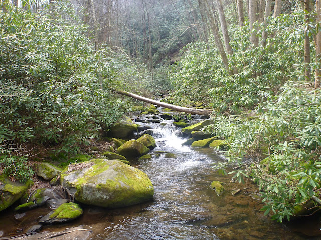
A beautiful hike that follows Middle Prong Creek

This is a really cool water slide to go down in the summertime

Trail bridge going over a small creek

Very old fire place out in the middle of no where

A small group of butterflies

Mother natures art work deep in the woods ..... so beautiful

Old service road bridge across the creek

Almost to Indian Falls

Indian Falls Waterfall ... 3 waterfalls in one

Second falls down from Indian Flats

I love waterfall hikes so much

This was spooky a rock that spelled out my intials in moss ...... M G

Friday, September 28, 2012

Waterfall Byway ... North Carolina Scenic Mountain Drive

Follow the winding Waterfall Byway west along U.S. 64 beginning at the intersection with N.C. 215, north of Rosman in Transylvania County. This byway earns its name from the 200 waterfalls that surround the route. In fact, the county, in which the route begins, is known as the ‘Land of Waterfalls’ for the many waterfalls and trout streams in the area.

Cross the French Broad River, whose Cherokee name means “racing waters,” near Rosman at the beginning of the route. It is about seven miles to the curve where U.S. 64 crosses the Toxaway River at Toxaway Falls (pictured here) on the left and Lake Toxaway to the right. Do not park on the shoulder of the road; it is unsafe for both motorists and pedestrians. Local merchants have provided some parking so that you may view the falls. From Toxaway it is about three miles into the Sapphire Valley resort area. Pass by Lakes Fairfield and Sapphire, both privately owned, before crossing the Horse Pasture River, located about 1.5 miles east of Cashiers.

The town of Cashiers, located at the intersection with N.C. 107, is about 10 miles from Toxaway Falls. Cashiers (pronounced “Cash-ers” by locals) is one of the oldest resort communities settled by Low Country South Carolinians who wanted to get away from the coastal summer heat and humidity. South Carolina Governor and Confederate General Wade Hampton’s summer home, “High Hampton,” was located south of Cashiers and is still a favored resort area. The headwaters of the Chatooga River are within the town’s limits to the west.

From Cashiers it is four miles to Cowee Gap. From the gap, at the head waters of the Cullasaja River, it is eight winding miles to the town of Highlands, the highest incorporated community on the east coast. Follow U.S. 64 through this old resort town.
Founded in 1875, Highlands was located here because it lies at the intersection of lines formed from Chicago to Savannah and from Baltimore to New Orleans. Highlands was designed by Charles Hutchins and Samuel T. Kelsey of Kansas, who also designed the resort community of Linville.

Cross Lake Sequayah on the outskirts of Highlands. Two miles west of Highlands pass by the 120-foot drop of Bridal Veil Falls. The water from this fall flows into the Cullasaja River to the south. Use the provided parking area (just west of the falls) to enjoy its beauty from either side or underneath where the old highway ran.

Dry Falls, located about one mile west of Bridal Veil, is on the left. This fall, on the Cullasaja River, is so named because you can walk underneath the roaring water and not get wet. The U.S. Forest Service has developed a parking area for visitors to explore and enjoy this waterfall.
Enter the Cullasaja Gorge six miles west of Dry Falls. The gorge is formed by the Cullasaja River as it flows west into the Little Tennessee River. Note that the United States Forest Service has designated a portion of this route as the Mountain Waters Scenic Byway. About four miles from Dry Falls are the Cullasaja Falls. Located on the left heading west, this impressive cascade drops 310 feet in one-half mile. The drop may be difficult to see, so look carefully behind the trees far below. While in the Cullasaja Gorge you will be able to catch glimpses of the Cullasaja River below as it winds its way west. Also, enjoy the views of the Smoky Mountains and the Pisgah and Nantahala National Forests while looking for falcons in the trees along the gorge’s cliffs. From the Cullasaja Falls, it is another two miles to the community of Gneiss, named for the metamorphic rock that abounds in this area.

From Gneiss it is about five miles to the community of Cullasaja where the gorge ends. From there it is another 2.5 miles to the U.S. 23/441 interchange with U.S. 64 in Franklin. Franklin is best known for the treaty council held here between Sir Alexander Cuming and the Cherokee Indians in 1730. In 1761 the Cherokee were defeated by a force of whites, Chickasaws and Creeks. A mound in town marks the site of an early Indian village, Nikwasi.

Follow U.S. 23/441 South and U.S. 64 about 7.5 miles on the divided highway to the community of Cartoogechaye (pronounced “Car-too-gi-chay”). The mountains nearby are part of the Nantahala Mountain range in the Nantahala National Forest. Approximately four miles west, cross Winding Stair Gap, one of the early western passages along the Appalachian Trail. From here it is another two miles to the community of Rainbow Springs. It is 1.7 miles to Black Gap on the Clay and Macon county line.

While driving the 10 miles along the ridge crests of the Chunky Gal Mountains, enjoy the occasional scenic overlooks. Indian lore has it that a chunky maiden from nearby ran away to get married without her father’s permission. The dismayed thinner maidens of her tribe gave her the name ‘Chunky Gal.’
From the community of Shooting Creek it is about 8.5 miles to the town of Hayesville. About four miles east of Hayesville pass by Lake Chatuga, known as the “Crown Jewel” of the Tennessee Valley Authority lakes. The water is part of the Hiawasee River. Now the Clay County seat, Hayesville was named in 1891 for the county’s founder. Located in town is the site of Fort Hembree, one of the gathering places for the Cherokee who were forced to leave this part of the country for Oklahoma on what is known as the “Trail of Tears.”

About seven miles west of Hayesville, turn left onto Settawig Rd. (S.R. 1135) and follow it for 2.5 miles towards Brasstown. While in Brasstown visit the John C. Campbell Folk School, where craftsmen learn trades such as pottery, weaving and blacksmithing. From Settawig Rd. turn right onto Phillips Rd. (S.R. 1100) for one tenth of a mile to Brasstown Rd. (S.R. 1134). Turn left and follow Brasstown Rd. for three-tenths of a mile then turn right onto Cheringhelli Rd. (S.R. 1558). Follow Cheringhelli Rd. for 6.5 miles where the route ends in Murphy at the intersection with US 19/129 Bypass.

Murphy is the site of Fort Butler, a frontier fort in the early 1800s and a temporary stockade for the Cherokee who were on the “Trail of Tears.” Located at the junction of the Hiawasee and Valley Rivers, the town also was an early trading post. It is the southern terminus of the Great Smoky Mountains Railway (GSMR).
Because of winding mountain roads, travel time may be slow along the route. Travel time also may vary with the season.

Friday, September 14, 2012

Hiking And Why It Is Good For The Mind And Body

 Hiking Promotes Mental Health

Hiking is much more varied than many other types of exercise, particularly those undertaken in a gym. Not only can your workout be different each time, depending on the trail you take, but the landscape will also change, if only from the seasons. Hiking outdoors can help you to maintain your motivation for exercise by making it more interesting. Hiking can also be as social as you like. You might feel embarrassed about exercising on the streets or in a gym when you're first starting out, and hiking on an isolated trail will decrease the chances of feeling like people are judging you (although you should always tell someone where you are going for safety's sake). Alternatively, hiking with a group or a friend can feel more like entertainment than exercise, and campsites are often very friendly places where it is possible to meet new people.

Exercise is a very good stress reliever in any form, including hiking, and can also reduce insomnia, leading to better mental health. Hiking outdoors will help you feel closer to nature and natural rhythms, which may increase your happiness and help you feel more fulfilled. A difficult hike, for example, up a hill or mountain, can also help you feel like you've achieved something more tangible than completing a fitness circuit at the gym.

 Hiking Promotes Physical Health
Hiking is a great exercise because it is easy to adjust to any level of fitness. Outdoor hiking can be on a level, well maintained path, or up a pathless mountain. This makes it excellent for people who are hoping to improve their fitness, as they can simply take more and more difficult hikes. Losing weight is another benefit of hiking. This is particularly true of hiking uphill, as this can burn similar amounts of calories to jogging. Exercise can help reduce insulin resistance in both the short and long term.

As hiking puts pressure on your bones, it encourages healthy bone structure and reduces the chances of osteoporosis. Being exposed to sunshine will also increase your levels of vitamin D. Hiking is a cardiovascular activity, depending on how hard you push yourself during a hike, and thus has benefits for your cardiovascular system, such as reducing the chances of heart disease, and increasing your overall fitness. Hiking is excellent for muscle tone, particularly cross country hiking, as your body and legs have to compensate for the rough terrain by working harder.

Hiking is a wonderful activity that is easy to start and continue, due to its varied and customizable nature. Outdoor hiking can help you to lose weight, clear and ease your mind and build a healthier body.

Wednesday, September 12, 2012

Top Unique Reasons for Hiking in the Southern Appalachians

The Smoky Mountain Hiking Blog: Top Unique Reasons for Hiking in the Southern Appalachians: What makes hiking in the Southern Appalachian Mountains so special? Or, put another way, what are the things that make hiking in the Southern Appalachians unique?

I’ve been giving these questions some thought for sometime now, and have come up with a list of eight reasons that set the Southern Appalachians apart from the rest of the country. I must admit that some of these are not totally unique, but nonetheless are fairly rare, thus making them distinctive in terms of a hiking feature.

Here’s my list, in descending order:

8) Roan Mountain Goats: Grassy balds in the Great Smoky Mountains, such as Gregory and Andrews, require occasional mowing in order to prevent trees from reclaiming them. On Roan Mountain, however, they use goats!

For the last three years scientists have been testing the use of goats as a measure for keeping the more than 1000 acres of grassy balds in tact. The use of goats may help Roan Mountain in two ways: they appear to be far more economical than mowing, and there’s speculation that goats will actually help promote the germination of the rare Gray's Lily wildflower.

Known as the “Baa-tany Goat Project,” the goats are surrounded by a solar-powered electric fence from July thru September. The enclosure covers a one-half to one acre plot, and is moved every week or two as the goats deplete the vegetation growth.

For the past couple of years the Southern Appalachian Highlands Conservancy has been leading guided Goat Hikes on Roan Mountain, thus offering the public an excellent opportunity to see the goats in action and learn about their role in preserving the grassy balds.

7) Fire Lookout Towers: The Southern Appalachians are littered with old fire towers, remnants of a bygone era when rangers climbed their perches to look for wildfires in their respective patrol areas. Most of the towers were abandoned in the 1960s when it was decided that planes could monitor the mountains more economically.

Today, fire lookout towers have become popular hiking destinations, thanks in part to Peter Barr, author of Hiking North Carolina’s Lookout Towers, and the Carolina Mountain Club’s official hiking challenge of reaching 24 lookout towers in Western North Carolina. Many of the towers are still accessible, allowing hikers to soak in the 360-degree views from their prominent vantage points.

Some of the more notable fire towers in the Southeast in terms of architecture include Duckett Top Lookout Tower on Rich Knob in the Pisgah National Forest, Wayah Bald in the Nantahala National Forest, and of course the Mt. Cammerer fire tower in the Smokies.

6) Trail Days in Damascus: Trail Days is the annual Woodstock for hikers. It’s the mother of all hiking gatherings. It’s a celebration of all things Appalachian Trail. And it all happens in tiny Damascus, Virginia, also known as Trail Town, USA where the Appalachian Trail, the Virginia Creeper and the Iron Mountain Trail slice through the middle of town. Each year Damascus becomes the destination point for thousands of thru-hikers, veteran hikers and those who just love hiking and the Appalachian Trail. Trail Days is recognized as the largest trail event in the world, and many A.T. thru-hikers will time their hike in order to be in town in mid-May for the annual three day festival.

5) The LeConte Lodge: Although there are a handful of other national parks that offer hike-in lodging, one of the great traditions in the Great Smoky Mountains is overnighting in the lodge sitting near the top of 6,593-foot Mount LeConte. For those that don’t like backpacking, the lodge offers an excellent opportunity to enjoy a backcountry experience in relative luxury (compared to roughing it!). The LeConte Lodge also has a sister lodge at Big South Fork (Charit Creek) where the only access is hiking in as well. One other backcountry lodge in the southeast worth mentioning is the Len Foote Hike Inn at Amicalola Falls State Park in Georgia.

4) Azaleas, Mountain Laurel & Rhododendron: One of the great annual events in the Southern Appalachians is the spectacular Azalea, Mountain Laurel and Rhododendron blooms of late spring. For some of the best examples of these beautiful displays of Mother Nature, hike up to Gregory Bald in mid-to-late June to check out the world famous Azaleas that grow atop the 10-acre bald. Spence Field near Rocky Top has the finest display of Mountain Laurel that I’ve ever seen. Early-to-mid June is the best time to visit when they’re usually reaching peak bloom. For Rhododendron, your best bet is Roan Mountain which has the largest natural rhododendron garden in the world. Count on peak blooms arriving around mid-to-late June.

3) Natural Bridges & Sandstone Arches: With places like Arches and Canyonlands National Park, it’s likely that Utah is more synonymous with natural bridges in the minds of most people. However, hikers shouldn’t forget the abundance of natural bridges and sandstone arches that permeate the Southern Appalachians. The Red River Gorge Geological Area in the Daniel Boone National Forest has over 100 natural arches, making it the greatest concentration of arches east of the Rocky Mountains. The Big South Fork region also contains one of the highest concentrations of natural bridges in the eastern U.S., including the largest sandstone arches in the east. Other notable arches include Natural Bridge in Virginia - a National Historical Landmark, and Sewanee Natural Bridge in Tennessee.

2) The Appalachian Trail: It may not be the longest anymore, nor the most scenic, but it will always be the most iconic trail in the world. The Appalachian Trail, America's first National Scenic Trail, is one the most popular trails for day-hikers and thru-hikers alike. An estimated 4 million people hike at least part of it each year. My guess is that most of them know it’s one of the best ways to see and explore the scenic wonders of the Appalachian Mountains.

1) Grassy Balds: One of the great mysteries of the Southern Appalachians is whether or not the treeless mountain tops and ridges, known as “balds,” are natural or if they were manmade. For hikers, does it really matter? Balds provide outstanding vantage points for sweeping panoramic vistas of the Appalachian Mountains. Some of the balds with the best views in the Smokies include Gregory, Andrews, Spence Field and Rocky Top. Outside of the Smokies, hikers should check out Roan Mountain, Max Patch, Mt. Rogers, Shining Rock, Cheoah Bald, Big Bald or Black Balsam.

By  Jeff   " The Smoky Mountain Hiking Blog " 

Thursday, September 6, 2012

Five Tips for Fall Hiking

Autumn is a fine time to get into the mountains. The backcountry is bursting with fall color, crowds have thinned to a trickle, and the bugs are all but gone.

But like any type of recreation, hiking carries certain risks, and your safety is best ensured with preparation and caution. And shorter days, colder nights and quickly-changing weather like we often experience in autumn in the mountains can make even a simple day hike more risky than your average summer excursion.

When hiking in the fall, pack some extra caution into your backpack.
Carefully choose your hike destination, and take the time to check trail conditions and weather forecasts before you head out. Let someone know where you will be and when you plan to return. Bring warm clothes, and be prepared for any weather. And pack the backcountry essentials that could save your life should you get lost or injured.

Here are some tips for safe backcountry hiking in autumn:

1.Check the latest trail conditions. Many trails will have new snow, and our snow level will continue to drop as autumn goes on. Check for recent trip reports from other hikers to confirm your chosen trail is snow-free. And always call ahead to local ranger stations for conditions.

2.Let someone know where you are going, and when you expect to return (and call them when you do return). If your destination changes, follow up and let someone know. Here is an easy form to share your hike itinerary with someone.

3.Always pack the 10 Essentials on any hike, including a topographic map, compass, extra food, extra clothing, firestarter, matches, sun protection, a pocket knife, first-aid kit, and flashlight. In unpredictable weather, it’s also a good idea to bring some sort of emergency shelter, even on a day hike. Hiking poles or ice axes can be of help on stretches of unexpected icy or snow-covered patches. Remember, cell phones don't always get reception and batteries can fade quickly in cold weather. They are not a substitute for carrying the backcountry essentials that could save your life.

4.Watch weather forecasts. This time of year, weather can turn cold and rainy, even snowy, in an instant. Hikers should turn back if encountering treacherous snow and ice unless equipped with a pair of crampons and a good pair of hiking poles to help navagate on snow and ice.

5.Be aware of hunting seasons. Autumn is hunting season, and each year hunters come out to pursue elk, deer, and other game. Read our tips for staying safe around hunters.
 

Tuesday, September 4, 2012

List Of Long Distance Hiking Trails

Trails

This is a list of long distance trails in the US that are at least 100 miles in length and are primarily footpaths. Most of these trails are maintained by hiking clubs and outdoor recreational organizations. Please consider joining these organizations, becoming a trail maintenance volunteer, making a donation, or purchasing merchandise from their web site stores. These are all great trails. so get out there and hike them.

Appalachian Trail
As probably the best known long distance trail in the US, the Appalachian trail spans 2,181 miles from Maine to Georgia. Many local trail organizations contribute time and effort to maintaining sections of the trail.

Arizona Trail
The Arizona Trail is a primitive long distance trail, nearly 800 miles long, that traverses the state of Arizona from Mexico to Utah. The rail is broken into 43 sections that are 11 to 35 miles in length.

Benton MacKaye Trail
The Benton MacKaye Trail runs through the Appalachian Mountains of the southeast US for nearly 300 miles and passes through some of the most remote backcountry of Georgia, Tennessee and North Carolina.

Buckeye Trail
The Buckeye Trail forms a circuit around the state of Ohio and is neat 1,444 miles in length. There are 26 section to the Buckeye trail each named after a town or trail feature.

Cohos Trail
The Cohos Trail is a 162 mile trail in northern New Hampshire that stretches across the state's most remote and unpopulated terrain.

Colorado Trail
Stretching almost 500 miles from Denver to Durango, the Colorado Trail travels through the spectacular Colorado Rocky Mountains amongst peaks with lakes, creeks and diverse ecosystems. Trail users experience six wilderness areas and eight mountain ranges topping out at 13,334 feet.

Continental Divide Trail

The Continental Divide Trail links Mexico to Canada, passing through the states of Montana, Wyoming, Colorado and New Mexico. At this time, the CDT is not yet completed although significant portions have been completed in all 4 states. The Continental Divide separates the rivers and streams that flow east to the Atlantic Ocean from those that flow west to the Pacific.

Finger Lakes Trail
The Finger Lakes Trail is 562 miles long and connects the Catskills with the Allegheny Mountains passing through remote sections of New York State.

Florida Trail
The Florida Trail stretches the length of the State of Florida for nearly 1,400 miles. Portions of the trail that cross private land can only be hiked if you are a member of the Florida Trail Association, so join now.

Foothills Trail
The Foothills Trail is a 76 mile woodland path along the Blue Ridge Escarpment in northwestern South Carolina.

Horseshoe Trail
The Horse-Shoe Trail is a 140-mile hiking and equestrian trail that runs from Valley Forge to the Appalachian Trail in southeastern Pennsylvania. The trail runs roughly parallel to the I-76 turnpike from Harrisburg to Valley Forge.
  • Join the Horse-Shoe Trail Club
  • Guide to the Horse-Shoe Trail

Ice Age Trail
 The 1,000 mile Ice Age Trail is located entirely within the state of Wisconsin. The Trail goes through mixed forests, open prairies, marsh and wetland areas, along wide gravel rail-trails and established state park trails. It traverses farm fields, urban and residential areas, small communities and remote state and national forests.

John Muir Trail
The John Muir trail runs for 211 miles from Yosemite Valley to Mt. Whitney, in California. The trail is considered one of the most picturesque hikes in the US and trail elevation ranges from 8,000 feet to nearly 15,000 feet. Wilderness Permits are required to camp on the trail.

Long Path
the Long Path is a 326 mile hiking trail extending from the George Washington Bridge, north to John Boyd Thacher Park near Albany. Future plans are to extend the trail to the Mohawk River and eventually into the Adirondaks.

Long Trail
Built by the Green Mountain Club between 1910 and 1930, the 272 mile Long Trail is the oldest long-distance trail in the United States. The Long Trail follows the main ridge of the Green Mountains from the Massachusetts-Vermont line to the Canadian border as it crosses Vermont's highest peaks. It was the inspiration for the Appalachian Trail, which coincides with it for one hundred miles in the southern third of the state.

Mason Dixon Trail
The 193 mile long Mason-Dixon Trail starts on the Appalachian trial at Whiskey Spings in Cumberland County, PA and runs to Chadds Ford, PA, on the banks of the Brandywine River. The Mason Dixon trail system membership is aging and seeks new members and volunteers to help preserve this historic trail.

Metacomet-Monadnock Trail
The Metacomet-Monadnock Trial is 114 miles long and runs from the Connecticut-Massachusetts state line to Mt. Monadnock in New Hampshire. The M-M trail passes through  the most beautiful sections of Western Massachusetts and is maintains by the Western Massachusetts Chapter of the Appalachian Mountain Club.

Monadnock-Sunapee Greenway
The Monadnock-Sunapee Greenway is a 50 mile hiking trail linking Mount Monadnock with Mount Sunapee in southwestern New Hampshire. The trail winds along the Monadnock Highlands that separate the Connecticut and Merrimack River watersheds.

Mountains to Sea Trail
North Carolina's Mountains to Sea trail is a 935 miles long, stretching from Clingman's Dome in the Great Smokey Mountains National Park to Jockey's Ridge State Park on the Atlantic Ocean. The entire end-to-end trail is not completed, although significant portions are finished. .


North Country Trail
The North Country Trial is nearly 4,600 miles long and passes through 7 northern states including New York, Pennsylvania, Ohio, Michigan, Wisconsin,
  • Join the North Country Trail Association
  • Purchase maps and guides

Ouachita Trail
 The Ouachita Trail stretches 223 miles through the beautiful Ouachita Mountains of Arkansas and Oklahoma.

Ozark Highlands Trail
The Ozark Highlands Trail is 165 miles long and is located in northwest Arkansas.

The Ozark Trail
The Ozark Trail is 350 miles of trail that wind through the Missouri Ozarks, part of a 25-year-old concept to run a trail from St. Louis to the Arkansas border and eventually connect with the Ozark Highland Trail in Arkansas to create a 700-mile through-trail.

Pacific Crest Trail
The Pacific Crest Trail is 2,650 miles long and zigzags its way from Mexico to Canada through California, Oregon and Washington. The trail passes through a wide variety of habitats including desert, old-growth forest and alpine back country.

Pacific Northwest Trail
The Pacific Northwest Trail is 1,200 miles long and runs from the Continental divide to the Pacific, passing through the Rocky Mountains, the Selkirk Mountains, Pasayten Wilderness, the North Cascades, the Olympic Mountains and the Wilderness Coast.

Midstate Trail of Pennsylvania
The 285 mile Midstate Trail is the longest continuous footpath in Pennsylvania running from the Mason Dixon Line to the Pennsylvania/New York State border. The trail features spectacular vista from mountaintops and the remoteness of wild forests and streams.

Superior Hiking Trail
The Superior Hiking Trail is a 205 mile long footpath that follows the rocky ridgeline above Lake Superior in northeastern Minnesota from Two Harbors to the Canadian border. The trail has trailheads with parking lots every 5 to 10 miles, making it ideal for section hikers.


Tahoe Rim Trail
The Tahoe Rim Trail is a 165 mile loop around Lake Tahoe. About 50 miles of the trail overlap with the Pacific Crest Trail.

Tuscarora Trail
The Tuscarora Trail is a 248-mile route that parallels the Appalachian Trail in northern Virginia, West Virginia, Maryland and Pennsylvania. 


Monday, September 3, 2012

Blister Prevention & Treatment for Hikers

No one is immune to blisters. However, blisters are preventable if you understand the conditions that cause them and they will heal faster if you know how to treat them properly. In the following article I begin by explaining what blisters are why they occur. I then discuss techniques to prevent them from occurring, followed by guidelines for treating blisters that will expedite the healing process.

What Causes Blisters?

Blisters can be caused by burns, allergic reactions, and fungal infections. The most common cause of blisters resulting from hiking is friction. When your feet get hot and sweaty, your socks stick to your feet and begin to rub against the inside of your shoes or boots. The skin at the point of friction becomes red and irritated. Lymphatic fluid flows to the friction site gathering between the layers of skin to protect the area like a small balloon, eventually forming a bubble of fluid known as a blister. Blisters can also occur when your socks, boots or shoes get wet from the rain, snow, or a stream crossing.

Why Blisters Form :

Blisters need 3 things to form:
moisture
heat
friction
So that means that if your foot gets hot and starts to sweat, and you’re wearing shoes that are rubbing against your skin just right, then you can get a blister.

Should You Pop Blisters?

Personally, I always pop my blisters with a sterilized needle, drain them and then put a bandaid with antibiotic cream on them to keep them from getting infected.
However, there are some people who say that you should never pop a blister. Why? Because the blister is "nature’s bandaid." It’s thought if you pop a blister, bacteria will have contact with the unprotected skin, which leaves you open to infection.
That said, there are some times when popping a blister is necessary — such as when it interferes with your being able to wear your shoes. Or, when the blister interferes with other things that you need to do in life.

How Blisters Form

Blisters are simply a build-up of fluid between different layers of skin.
A blister is created when something rubs the outer layer of skin and causes it to then rub the inner layer of skin. This, in turn, causes the outer layer to come loose from the inner layer. It is at this point that your body then fills up the space with lymph fluid.
When this happens, the outer layer loses any contact with oxygen and nutrients, and at that point  becomes dead skin.
If you pop the blister, or it pops on its own, then your skin is no longer protected since the outer skin is dead.

Blister Prevention

The key to preventing blisters is to eliminate friction. Shoes and boots should be well broken in and you should make an effort to keep your socks as dry as possible by changing them when your feet get hot and sweaty or by taking your shoes or boots off periodically to let your feet and socks dry out when you take a snack break. If this means bringing along one or two extra pairs of socks, it may be well worth a few more ounces of pack weight.

If you expect to do a lot of stream crossings you should consider bringing along a pair of sandal or crocs to wear instead of your boots to keep them dry. Bringing along a pair of camp shoes also gives your boots and socks an opportunity to dry for a longer period of time before you need to put them back on again. Conditions permitting, you may also want to re-evaluate a preference for leather hiking boots. Ultralight hikers who wear lightweight boots, running shoes or even sandals may experience less blisters because their footware drys more quickly when it gets wet. Gore-Tex lined leather boots, on the other hand, can take days to dry out completely.

Other effective ways to reduce friction include applying petroleum jelly to a hot spot or sprinkling foot powder or corn starch on your feet to prevent moisture buildup. If you feel a hot spot forming on your feet, you should stop to inspect it immediately and apply moleskin or tape to prevent it from turning into a blister later in the day. Some hikers also prefer wearing two sock layers, a liner which absorbs moisture and can be changed frequently, and a heaver outer sock. This moves the site of friction between the socks, away from your skin and a sock.

 Blister Treatment

Blisters come in different shapes and sizes. The first stage in determining how to treat a blister is to assess it. Broken blisters that are leaking fluid should be disinfected and bandaged. Unbroken blisters that are painful should be pricked with a sterile needle and drained. Small blisters that are not painful should be left alone because the best protection against infection is the blister’s own skin. These will heal by themselves and will be reabsorbed in a few days.

If a blister has broken, it should be cleaned, disinfected and then bandaged. You can disinfect the would by irrigating it with chlorinated water, wiping it with an alcohol swab, or rubbing it with a dab of Purell. If the skin over the blister is ragged and dirty it should be carefully cut off. Otherwise it should be left intact to prevent infection. Before bandaging the wound, an antibiotic oitment should be applied. Research has shown that the application of Neosporin or triple antibiotic gel will kill of infecting bacteria after two applications and accelerate the healing process.

Unbroken blisters that are painful should be drained. This is caused by the build up of fluid in the blister, so removing it will help relieve the pain. First swab the blister with alcohol to disinfect the area. Then, using your fingers, push the fluid to one side of the blister. Prick the side with the fluid using a needle that has been sterilized by alcohol, a lighted match or in boiling water. The needle should prick the blister horizontally at the point where the blister begins to rise above the skin. Leave the skin overlying the blister in place to prevent infection. Apply antibiotic gel to the site of the needle pricks and cover with a bandage. For small blisters, cover the entire blister with an adhesive bandage. For larger blisters cover the entire blister with a porous, plastic-coated gauze pad that will absorb any further drainage and allows the blister to breath and dry out. If the bandages get wet, reapply the antibiotic ointment and redress the blisters. After a few days, the skin under the blister should have healed and you can cut away the remaining dead skin.

Other Folk Remedies

 
If you hang around long distance hikers and backpackers long enough, someone will suggest using Superglue to help heal a blister or make it possible to keep walking with one. This suggestion is actually a lot less far-fetched than it sounds. Superglue is widely used by surgeons to bond together organs or parts of the body that respond poorly to stitches. It is also effective in closing skin shears like cracked calluses where the sides of a wound must be bonded to accelerate healing.

Superglue can be used to treat blisters by squirting it between top of a popped blister and the skin beneath it. This bonds the roof of the blister to the underlying skin reducing the risk of infection and creating a hardened shell over the blister site. The downside of this technique is that the solvents in the Superglue will hurt like hell when they are applied to the wound. To be on the safe side, make sure that you have sterilized the blister with alcohol before applying Superglue to it.
Tincture of Benzoin is another bonding agent that can be also be used to seal the roof of the blister to the exposed skin underneath. It already contains alcohol, so a separate application is unnecessary.

The Mountain Life Festival at Oconaluftee

The Smoky Mountain Hiking Blog :

Join park staff and volunteers as they celebrate the fall harvest. The Mountain Farm Museum will be alive with history as demonstrators provide visitors with a glimpse into the past as they make soap, apple cider, sorghum molasses, hominy, music and more.

This year's Mountain Life Festival will be held on September 15th at the Mountain Farm Museum next to the Oconaluftee Visitor Center near Cherokee, NC from 10 am - 4 pm.

The centerpiece of the event is the sorghum syrup demonstration, which the national park has provided each fall for nearly 40 years. The syrup is made much the same way it was produced a hundred or more years ago using a horse-powered cane mill and wood-fired cooker. The syrup making demonstration is provided by students, staff, and volunteers from Swain County High School through a cooperative agreement with Great Smoky Mountains National Park and the Great Smoky Mountains Association.

Tools, farm implements, and historic photographs from the national park's archives and artifact collection will also be on display.

The purpose of the Mountain Life Festival is to share with park visitors some of the traditional fall activities that were an important part of rural life in the southern mountains. The spirit of cooperation that existed among families and neighbors is reflected in this event.

Sunday, September 2, 2012

Best Hiking Trails In North Carolina

#1. Mount Mitchell

Mt. Mitchell—the highest peak east of the Mississippi—is a crowning part of the Blue Ridge Parkway experience. The only motorized access to the mountain is from the Parkway, at Milepost 355.3, and the…
From the guidebook "Hiking the Blue Ridge Parkway"
Asheville, NC - Hiking - 12 miles  

  
#2. Uwharrie National Forest Trails

Uwharrie National Forest is an increasingly attractive “best kept secret” where state-designated Scenic Byways meander through the undulating remains of North America’s oldest mountain range. The stat…
From the guidebook "Hiking North Carolina"
Asheboro, NC - Hiking - 66.5 miles   

 
#3. Mount Pisgah Area Trails

Driving the Parkway from Asheville to Mt. Pisgah is a humbling experience —especially if you stopped by Biltmore House and Gardens on the way through town. George W. Vanderbilt’s fascinating palatial…
From the guidebook "Hiking the Blue Ridge Parkway"
Brevard, NC - Hiking - 6.4 miles 

   
#4. Gregory Bald Overnight Loop

This hike combines the best that the high and low country have to offer. First, you'll travel up the Twentymile Trail past Twentymile Cascades to the Upper Flats streamside camp. Then an arduous climb…
From the guidebook "Day & Overnight Hikes in the Great Smoky Mountains National Park"
Fontana Village, NC - Hiking - 15.7 miles  

  
#5. Appalachian Trail: Clingmans Dome to Spence Field

This hike is a long, difficult, beautiful hike, and by the end, you will have your own definition of a southern Appalachian knob. The trail follows an easy descent for about 3 miles; then a short roc…
From the guidebook "Exploring the Appalachian Trail: Hikes in the Southern Appalachians"
Cades Cove, NC - Hiking - 22.1 miles 

   
#6. Appalachian Trail in North Carolina

Each spring nearly 1,500 people hoist unbelievably heavy packs onto their backs and strain down a misty trail, intent on accomplishing the most difficult task of their lives: going the length of the A…
From the guidebook "Hiking North Carolina"
Bakersville, NC - Hiking - 318 miles  

  
#7. Craggy Gardens Trails

How can names like Craggy Gardens, Craggy Dome, and Craggy Pinnacle not inspire hikers? Visible from all over northwest North Carolina, these barren crests offer awesome views. As the Blue Ridge Parkw…
From the guidebook "Hiking North Carolina"
Asheville, NC - Hiking - 9.6 miles  

  
#8. Shining Rock Wilderness Trails

Shining Rock—like the Craggy Mountains and Mount Mitchell just north of Asheville—is where the Parkway delivers some of the southern Appalachians’ most stunning scenery. The horizon peels back on an a…
From the guidebook "Hiking North Carolina"
Waynesville, NC - Hiking - 68.5 miles  

  
#9. Shining Rock Wilderness

As you drive south out of Asheville and climb past Mt. Pisgah, the Shining Rock Wilderness can’t help but catch your attention. The horizon peels back on an almost Western scale, and meadow-covered m…
From the guidebook "Hiking the Blue Ridge Parkway"
Brevard, NC - Hiking - 8.8 miles 

   
#10. Linville Gorge Wilderness

A 12,002-acre tract of designated wilderness, Linville Gorge lies between Jonas Ridge to the east and Linville Mountain to the west. The Blue Ridge Parkway skirts the head of the gorge on the northwes…
From the guidebook "Hiking the Blue Ridge Parkway"
Crossnore, NC - Hiking - 14 miles  

  
#11. Appalachian Trail: Allen Gap to Devil Fork Gap

The northern half of this hike borders the Bald Mountain Ridge Scenic Area in the Cherokee National Forest, and the AT runs along a rugged, isolated crest. Outstanding views, masses of rhododendron a…
From the guidebook "Exploring the Appalachian Trail: Hikes in the Southern Appalachians"
Hot Springs, NC - Hiking - 20.2 miles   

 
#12. Appalachian Trail: Carvers Gap to Roan High Bluff & Rhododendron Gardens

Roan Mountain is a place of mystery, legend, wild beauty, and superlatives. The largest of the southern Appalachian grassy balds, it also boasts one of the most beautiful displays of Catawba rhododen…
From the guidebook "Exploring the Appalachian Trail: Hikes in the Southern Appalachians"
Bakersville, NC - Hiking - 5.6 miles    


#13. Appalachian Trail: Carvers Gap to US 19E

Wide-open spaces, miles of waving grass, alpine wildflowers … Is this the southern Appalachians? Botanist Asa Gray observed in the 1880s that he could ride his horse for 14 miles on Roan Mountain and…
From the guidebook "Exploring the Appalachian Trail: Hikes in the Southern Appalachians"
Roan Mountain, TN - Hiking - 13.4 miles  

   
#14. Appalachian Trail: Davenport Gap to Max Patch

Because of distance and several long ups and downs, the rating on this hike is "strenuous," but in general the grade is good with no difficult or rough spots. The trail passes through peaceful second…
From the guidebook "Exploring the Appalachian Trail: Hikes in the Southern Appalachians"
Waterville, NC - Hiking - 16 miles  

 
#15. Foothills Trail: Bad Creek Access to Rocky Bottom

This is one long and spectacular section of trail. It is hard to find 30 miles of trail in the East without crossing a major road, but the Foothills Trail delivers. It occasionally passes by normally…
From the guidebook "Long Trails of the Southeast"
Salem, SC - Hiking - 30.3 miles    

 
#16. Graveyard Fields Loop Trail

A loop that reaches two waterfalls and explores a high, alpine-like valley. A second circuit involves a new portion of the Mountains-to-Sea Trail. Hikes on the well-maintained but heavily traveled Gra…
From the guidebook "Hiking the Blue Ridge Parkway"
Brevard, NC - Hiking - 9.5 miles   


#17. Grandfather Mountain

Grandfather Mountain is a rocky, spectacular summit known to tourists for great views from its privately owned road and Mile-High Swinging Bridge. The peak is one of the region’s premier natural areas…
From the guidebook "Hiking the Blue Ridge Parkway"
Linville, NC - Hiking - 4.8 miles  

 
#18. Charlotte Trails

The Mecklenburg County Parks and Recreation Department boasts a diverse system of trails, with 35 miles of trails in five nature preserves and another 22 miles in eight urban greenways. This award-win…
From the guidebook "Hiking North Carolina"
Charlotte, NC - Hiking - 28 miles    ..

Wednesday, August 29, 2012

Grandfather Mountain Mile High Swinging Bridge


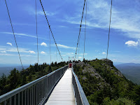
One of the great hikes at Grandfather Mountain is the trail to the mile high swinging bridge which is located near Linville Peak. The hike to the mile high swinging bridge is spectacular as it offers stunning views over the North Carolina high country. The hike is a loop that utilizes the Bridge Trail, the Grandfather Trail and the Grandfather Trail Extension.
Directions to Trailhead: The entrance to Grandfather Mountain is located on US 221, two miles north of Linville, North Carolina, and one mile south of the Blue Ridge Parkway at milepost 305. The street address for the entrance is: 2050 Blowing Rock Highway, Linville, NC 28646. The road to the summit is referred to as Grandfather Mountain Entrance Road, Linville, NC. Once inside Grandfather Mountain follow the road to the Grandfather Mountain trails parking area, there is a sign for the parking area just before you reach the Top Shop area at the end of the road. For a map of the location where Grandfather Mountain is click Here. For a map of trails at Grandfather Mountain click Here.

Description of Hike: The hike to the mile high swinging bridge at Grandfather Mountain is a loop that utilizes several trails. The trail is well maintained however much of the trail contains uneven rocks and roots from nearby trees. From the parking area take the Bridge Trail 0.4 miles to the Top Shop area. It is at this point that you cross the mile high swinging bridge (Actually it is more than a mile high), to Linville Peak which is 5,303 feet in elevation and provides great views of Grandfather Mountain and the surrounding North Carolina Mountains. Return back across the bridge and cross the parking area and take the Grandfather Trail to proceed back down to the parking area. In just under 0.4 miles from the Top Shop area at the mile high swinging bridge you will intersect with the Grandfather Trail Extension which will take you back to the the Trails Parking area at Grandfather Mountain. From the trail intersection to the Parking area is 0.6 miles for a total hike of approximately 1.6 miles roundtrip and approximately 350 feet of elevation gain. We would classify this as a moderate hike due to the intensity of the terrain. There is a fee per person to enter Grandfather Mountain, for current costs click Here. If you want a longer hike you can hike to MacRae Peak which is located at an elevation of 5,845 feet. This will add an additional 1.2 miles roundtrip and an additional 400 feet in elevation gain for a total hike of 2.8 miles and 650 feet of elevation gain, which we classify as strenuous. For more information about this add on to MacRae Peak click the link below.

Further Thoughts: The hike to Grandfather Mountain's mile high swinging bridge is a must do when you visit Grandfather Mountain. The terrain the hike goes through is unparalleled and the views continue to get better the higher up the mountain you go. We found that the trails were well marked and were well maintained by park staff. Additionally, since this is a popular hiking trail at Grandfather Mountain, you will likely see other visitors out enjoying the trails.

The Mile High Swinging Bridge was built to give visitors easy access to the breath-taking view from Grandfather Mountain's Linville Peak. The 228-foot suspension bridgespans an 80-foot chasm at more than one mile in elevation. Surveys by the staff at Grandfather Mountain have shown that the journey to the other side of the mile high swinging bridge is always considered the highlight of a trip to Grandfather Mountain.

The Mile High Swinging Bridge was originally constructed in 1952 and was rebuilt in 1999 using the original towers. The cables, floor boards and side rails were all replaced using galvanized steel. One of the main advantages of the modern building materials is that they do not have to be painted. Now Grandfather Mountain employees will not have to hang out over the gorge to paint the span. The 228-foot steel structure is America's highest suspension footbridge.


Rating: Elevation Gain: 350 ft. (Moderate), Distance: 1.6 Miles (Moderate).