Showing posts with label Beautiful. Show all posts

Tuesday, November 13, 2012

Hike To Joyce Kilmer


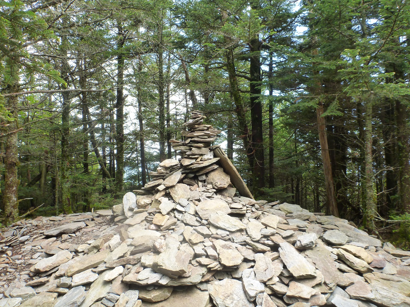
The Joyce Kilmer Memorial Forest along Little Santeetlah Creek is a rare example of an old growth cove hardwood forest, an extremely diverse forest type unique to the Appalachian Mountains. Although there are many types of trees in Joyce Kilmer, dominant species include poplar, hemlock, red and white oak, basswood, beech, and sycamore. Many of the trees in Joyce Kilmer are over 400 years old. The largest rise to heights of over 100 feet and have circumferences of up to 20 feet . The Slickrock Creek basin is coated primarily by a mature second-growth cove hardwood forest, although a substantial old growth stand still exists in its upper watershed.

The Joyce Kilmer-Slickrock Wilderness borders the Citico Creek Wilderness, which lies within the Cherokee National Forest in Tennessee.

Information board at Joyce Kilmer Trailhead

Dedicated July 30, 1936 by the U S Forest Service

Such a beautiful forest with lots of old trees and growth

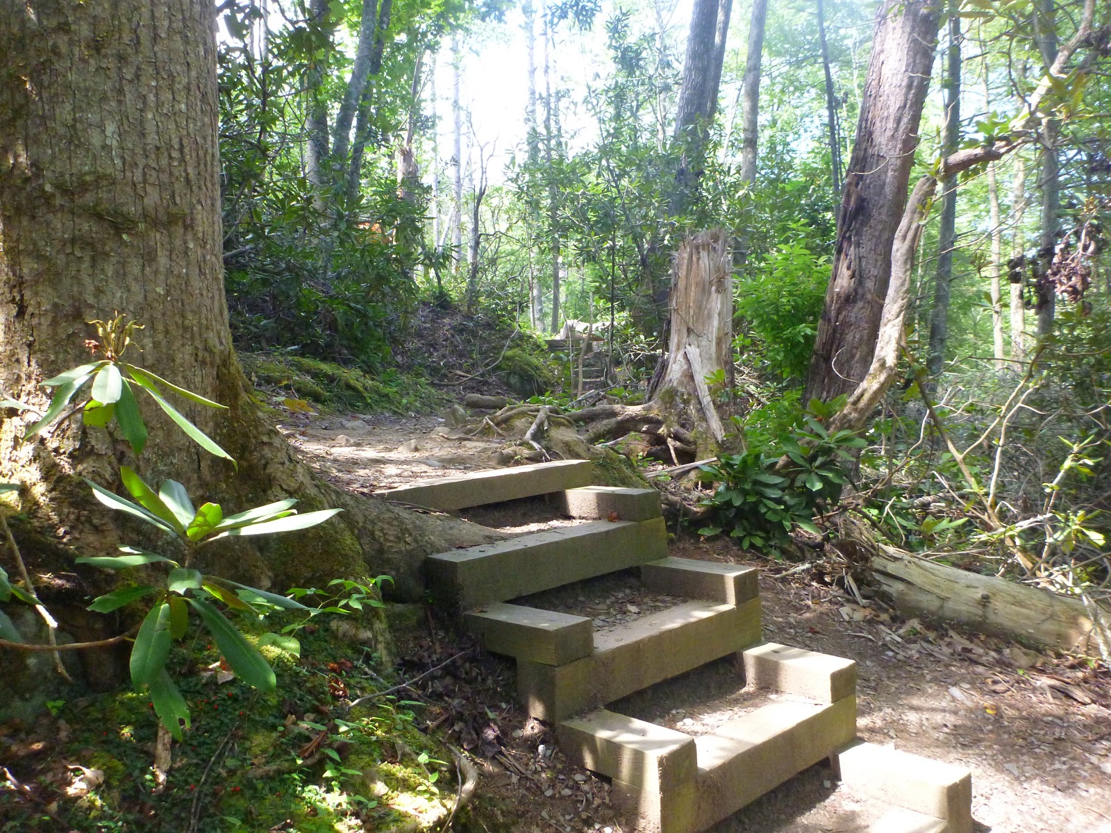
This is a very well maintained trail great for kids and the elderly

Lots of trees snapped from a storm earlier in the year

Two more trees that was clipped by high winds

Poor trees took a beating from this storm

Amazing trees growing on top of the ground .Mysteries of the wildreness !

Joyce Kilmer - Soldier , Poet and Author of " Trees "

Some of the trees in Joyce Kilmer are 400-500 years old

And trees measuring over 100 feet tall

Twin giants in the trail .... so huge so majestic
Even trees walk in this forest on the trails

Almost to the end of the hike of the man who felt trees were so important that he wrote a poem about them

Trees

I Think that I shall never see
A poem lovely as a tree.

A tree whose hungry mouth is prest
Against the sweet earth's flowing breast;

A tree that looks at God all day,
And lifts her leafy arms to pray;

A tree that may in summer wear
A nest of robins in her hair;

Upon whose bosom snow has lain;
Who intimately lives with rain.

Poems are made by fools like me,
But only God can make a tree.


- Joyce Kilmer

Saturday, November 3, 2012

Hike To Mt. LeConte Via Rainbow Falls After 3 Ft. Of Snow From Sandy Pt 5


These are pictures that I took on a hike from Rainbow Falls via Mt. LeConte after Hurricane Sandy had dumped over 3 feet of snow on Mt. LeConte and The Great Smoky Mountains above 5,ooo feet . Such beauty in the snow covered mountains makes everything so pure , so beautiful and so mysterious ! I hope you enjoy all the pictures . Happy Hiking !

Happy Halloween the day after ....... lol

Just November 1st and all this snow !

Solar Panels provide electricity for computer post

Picture perfect postcard

Besides the crew at the time i was up there only 4 people was at the lodge

Winter Wonderland in the Smoky Mountains

“Snow on one side of the canvas, silence on the other. I’d call that a perfect painting.”
― Jarod Kintz

Would like to thank the entire crew of Mt. LeConte Lodge for being so nice and all their hard work that a lot of people don't see to keep them happy and safe ..... Great Job and Thank you all

Hike To Mt. LeConte Via Rainbow Falls After 3 Ft. Of Snow From Sandy Pt.4


These are pictures that I took on a hike from Rainbow Falls via Mt. LeConte after Hurricane Sandy had dumped over 3 feet of snow on Mt. LeConte and The Great Smoky Mountains above 5,ooo feet . Such beauty in the snow covered mountains makes everything so pure , so beautiful and so mysterious ! I hope you enjoy all the pictures . Happy Hiking !

Amazing the amount of snow on all the trees

Even in the aftermath of the storm beauty can appear

“For the listener, who listens in the snow, / And, nothing himself, beholds /
Nothing that is not there and the nothing that is.”
― Wallace Stevens


Is this the steps to LeConte or the snow slide ?

Hurricane Sandy dumped over 3 feet of snow on the mountains

Winter wonderland set down on the mountain in the fall

So peaceful and so quite when I got there

Snow drifts to the roofs on some of cabins

Dining Room and kitchen at Mt. LeConte Lodge

One of the cabins at Mt. LeConte Lodge

Sunday, October 28, 2012

GSMNP Fall Color Report

Fall color report October 26

Fall colors are now at peak at the lower elevations of the Great Smoky Mountains. Some of the best places to enjoy them right now are Rich Mountain Road (out of Cades Cove), The Foothills Parkway East (Cosby area) and West (Walland area), Little River Road, and the Deep Creek and Cosby areas of the park. Suggested hikes include Little River Trail, Deep Creek Trail, Abrams Falls, Smokemont Loop, and Hen Wallow Falls.

Elevations 4,500 feet and above leaves are falling off fast very fast !


Fall color season will soon be coming to an end, so don’t wait any longer!

Happy Hiking ,
Atti's Taxi
Matt

Saturday, September 29, 2012

Why Leaves Change In The Fall

Why Leaves Change
Every autumn we revel in the beauty of the fall colors. The mixture of red, purple, orange and yellow is the result of chemical processes that take place in the tree as the seasons change from summer to winter.


During the spring and summer the leaves have served as factories where most of the foods necessary for the tree's growth are manufactured. This food-making process takes place in the leaf in numerous cells containing chlorophyll, which gives the leaf its green color. This extraordinary chemical absorbs from sunlight the energy that is used in transforming carbon dioxide and water to carbohydrates, such as sugars and starch.

Along with the green pigment are yellow to orange pigments, carotenes and xanthophyll pigments which, for example, give the orange color to a carrot. Most of the year these colors are masked by great amounts of green coloring.

Chlorophyll Breaks Down

But in the fall, because of changes in the length of daylight and changes in temperature, the leaves stop their food-making process. The chlorophyll breaks down, the green color disappears, and the yellow to orange colors become visible and give the leaves part of their fall splendor.

At the same time, other chemical changes may occur, which form additional colors through the development of red anthocyanin pigments. Some mixtures give rise to the reddish and purplish fall colors of trees such as dogwoods and sumacs, while others give the sugar maple its brilliant orange.

The autumn foliage of some trees shows only yellow colors. Others, like many oaks, display mostly browns. All these colors are due to the mixing of varying amounts of the chlorophyll residue and other pigments in the leaf during the fall season.

Other Changes Take Place

As the fall colors appear, other changes are taking place. At the point where the stem of the leaf is attached to the tree, a special layer of cells develops and gradually severs the tissues that support the leaf. At the same time, the tree seals the cut, so that when the leaf is finally blown off by the wind or falls from its own weight, it leaves behind a leaf scar.

Most of the broad-leaved trees in the North shed their leaves in the fall. However, the dead brown leaves of the oaks and a few other species may stay on the tree until growth starts again in the spring. In the South, where the winters are mild, some of the broad-leaved trees are evergreen; that is, the leaves stay on the trees during winter and keep their green color.

Only Some Trees Lose Leaves

Most of the conifers -- pines, spruces, firs, hemlocks, cedars, etc. -- are evergreen in both the North and South. The needle- or scale-like leaves remain green or greenish the year round, and individual leaves may stay on for two to four years or more.

Weather Affects Color Intensity

Temperature, light, and water supply have an influence on the degree and the duration of fall color. Low temperatures above freezing will favor anthocyanin formation, producing bright reds in maples. However, early frost will weaken the brilliant red color. Rainy and/or overcast days tend to increase the intensity of fall colors. The best time to enjoy the autumn color would be on a clear, dry and cool (not freezing) day.

Enjoy the color; it only occurs for a brief period each fall.


Tuesday, September 18, 2012

Fall Color Report For The Great Smoky Mountains

September 18 Fall Color Report

Although it’s only mid-September, spots and splashes of fall color are beginning to appear in the Great Smoky Mountains. At the lower elevations, early changers like black gum, Virginia creeper, and sourwood are showing bright reds.

At the mid elevations, yellow buckeyes are shifting toward gold while yellow birch, American beech, and some maples are showing hints of color.

At the highest elevations, fall has arrived. American mountain-ash has changed to orange or yellow and witch-hobble has gone to burgundy.

Wildflowers continue to be spectacular with jewelweed, goldenrod, New York ironweed, cardinal flower and great blue lobelia putting on a brilliant show.

Recommended hikes include Clingmans Dome Tower, Forney Ridge Trail to Andrews Bald, Road Prong, Thomas Divide, and Charlies Bunion. Good drives are the Blue Ridge Parkway, Balsam Mountain Road, and Clingmans Dome Road.

Information from : Great Smoky Mountains Association

Sunday, September 16, 2012

Hike To Myrtle Point Via Rainbow Falls / Mt.LeConte

Trail Description:
If you're trying to decide which trail to take to Mount LeConte: the Rainbow Falls Trail or Bullhead, I would recommend taking the Bullhead Trail because of the views along the way, (unless, of course, you specifically want to see Rainbow Falls). However, because the Rainbow Falls Trail is less exposed than Bullhead, the Rainbow Falls Trail might be a little cooler in the summer as you ascend to the summit of Mount LeConte. 
If you were doing a loop hike, especially during the summer, I would definitely hike up Rainbow Falls Trail and then descend via Bullhead.
The trail begins at the southwest corner of the parking lot. For the first two-thirds of a mile you'll climb steadily over a boulder-strewn pathway, while LeConte Creek cascades down the mountain on your right. There are many opportunities for some great picnic sites along this section of the trail.

The trail crosses over two footbridges, one at 1.7 miles, and the other at 2.4 miles, before reaching the 80-foot high waterfalls at 2.7 miles. Rainbow Falls is the highest single-drop waterfall in the Smokies. It receives its name from the rainbow that's produced by mist and becomes visible on sunny afternoons. During extended winter cold spells, an impressive ice formation builds around the falls. You may notice a little bit of ice just to the right of the falls in the picture on the left.
To continue on to Mt. LeConte, cross the footbridge at Rainbow Falls. Over the next 3.2 miles you'll climb more than 1700 feet before reaching the Bullhead Trail junction. This section of trail will take you past rhododendron, sand myrtle and mountain laurel that offer hikers beautiful mountain blooms during the spring.
At 5.4 miles, you'll arrive at a side trail, which loops back to the main trail after a short distance. The loop leads to Rocky Spur, an outcropping of rocks that offers nice views of the valley below.
At just under 6 miles from the trailhead you'll reach the Bullhead Trail junction. Turn left to continue on to the summit of Mount LeConte.
In another 0.4 miles you'll reach the Alum Cave Trail, which forks in from the right. At this point you'll have your first views of the LeConte Lodge.
A lot people end their hike at the lodge, however, to reach the true summit of Mount LeConte, you still need to walk almost another half-mile.
Before reaching the top of the mountain, the Trillium Gap Trail will branch off to your left at 6.6 miles. The summit, better known as High Top, will be at 6.9 miles. You'll know you've reached the highest point on Mt. LeConte when you've reached the cairn, or pile of rocks, just off the main trail on the right.Then one of the most incredible views in The Great Smoky Mountains is only .09 of a mile away called Myrtle Point . Believe me this is well worth the extra mile !


At 6593 feet, Mount LeConte is the third highest peak in the Smokies. However, measured from its immediate base to its highest point, Mt. LeConte can be considered the tallest mountain in the Eastern United States, rising 5301 feet from its base near Gatlinburg.

There is considerable controversy over which member of the LeConte family the mountain was named for. Most people, including the USGS, assume that Joseph LeConte, the famous geologist and charter member of the Sierra Club, is the man for whom the mountain was named. However, that claim has been challenged in recent years. The authors of A Natural History of Mount Le Conte, and the Georgia Encyclopedia, both claim the name honors Joseph's older brother, John, who was famous as a scientist and as president of the University of California, at Berkeley.
Unfortunately you won't have any vistas up at High Top. However, there are two places on the mountain that do afford outstanding panoramic views.

One is at Myrtle Point. 
To get to Myrtle Point you'll need to walk another 0.4 miles by continuing on the main trail, which has now turned into the Boulevard Trail. Roughly 0.2 miles from High Top, take the fork off the right side of the trail. Myrtle Point is another 0.2 miles from this junction. This vantage point provides nearly 360 degree views, and is the best location for sunrises on Mt. LeConte

The other place to go for outstanding views is known as Cliff Top, which is near the LeConte Lodge. You will have passed two side trails to Cliff Top, on your right, as you made your way up to High Top. Cliff Top is the best location for sunset views.  
One of the unique things about the hike up to Mount LeConte is the lodge and overnight cabins at the top. Hikers have the option of spending the night in the historic cabins which can accommodate about 50 guests a night (you will need reservations well in advance). For more information, visit the LeConte Lodge website.

The idea for the lodge was created when Paul Adams, an enthusiastic hiker and explorer, led an expedition up the mountain with some dignitaries from Washington D.C. to show them the rugged beauty of the Great Smoky Mountains, and to help promote the cause for the creation of a national park. The group spent the night in a large tent. The following year Adams built a cabin on that same spot, which eventually led to the establishment of the LeConte Lodge.   

 Adams is also credited with blazing the trail from Alum Cave up to the summit of Mount LeConte.


Hiking up Rainbow Falls Trail to Mt.LeConte and on to Myrtle Point 

Have always loved the log bridge crossings while hiking in the GSMNP 

Rainbow Falls water was very low this time up due to lack of rain fall early in the year


Rhododendron blooms still fresh with the morning dew     


The famous Mt.LeConte Dining Room with date and elevation

A beautiful view on the way to Myrtle Point just pass Mt.LeConte Lodge

Actual highest point of Mt.LeConte 

This is my hiking buddy Atti at Myrtle Point enjoying the view .... lol

Breath taking views from Myrtle Point

Another breath taking view from Myrtle Point  


Friday, September 14, 2012

Hiking And Why It Is Good For The Mind And Body

 Hiking Promotes Mental Health

Hiking is much more varied than many other types of exercise, particularly those undertaken in a gym. Not only can your workout be different each time, depending on the trail you take, but the landscape will also change, if only from the seasons. Hiking outdoors can help you to maintain your motivation for exercise by making it more interesting. Hiking can also be as social as you like. You might feel embarrassed about exercising on the streets or in a gym when you're first starting out, and hiking on an isolated trail will decrease the chances of feeling like people are judging you (although you should always tell someone where you are going for safety's sake). Alternatively, hiking with a group or a friend can feel more like entertainment than exercise, and campsites are often very friendly places where it is possible to meet new people.

Exercise is a very good stress reliever in any form, including hiking, and can also reduce insomnia, leading to better mental health. Hiking outdoors will help you feel closer to nature and natural rhythms, which may increase your happiness and help you feel more fulfilled. A difficult hike, for example, up a hill or mountain, can also help you feel like you've achieved something more tangible than completing a fitness circuit at the gym.

 Hiking Promotes Physical Health
Hiking is a great exercise because it is easy to adjust to any level of fitness. Outdoor hiking can be on a level, well maintained path, or up a pathless mountain. This makes it excellent for people who are hoping to improve their fitness, as they can simply take more and more difficult hikes. Losing weight is another benefit of hiking. This is particularly true of hiking uphill, as this can burn similar amounts of calories to jogging. Exercise can help reduce insulin resistance in both the short and long term.

As hiking puts pressure on your bones, it encourages healthy bone structure and reduces the chances of osteoporosis. Being exposed to sunshine will also increase your levels of vitamin D. Hiking is a cardiovascular activity, depending on how hard you push yourself during a hike, and thus has benefits for your cardiovascular system, such as reducing the chances of heart disease, and increasing your overall fitness. Hiking is excellent for muscle tone, particularly cross country hiking, as your body and legs have to compensate for the rough terrain by working harder.

Hiking is a wonderful activity that is easy to start and continue, due to its varied and customizable nature. Outdoor hiking can help you to lose weight, clear and ease your mind and build a healthier body.

Tuesday, September 11, 2012

Clingman's Dome In The GSMNP

Clingmans Dome is the highest point in the Great Smoky Mountains and in Tennessee.  From the top of the observation tower pictures above, one can, at times, see for over 100 miles in every direction. Unfortunately, these times are rare, and it is more common to be able to see for around 20 miles, which still provides outstanding views.


Clingmans Dome is also the third highest mountain east of the Mississippi. Only Mt. Mitchell (6,684 feet) and Mt. Craig (6,647), both located in Mt. Mitchell State Park in western North Carolina, rise higher. The observation tower on the summit of Clingmans Dome offers spectacular 360° views of the Smokies and beyond for visitors willing to climb the steep half-mile walk to the tower at the top.


 On clear days views expand over a 100 miles. Unfortunately, air pollution often limits viewing distances to under 20 miles.
Clouds, precipitation, and cold temperatures are common at Clingmans Dome. Temperatures at the dome can be 10 -20 degrees Fahrenheit cooler than in the surrounding lowlands. In fact, the cool, wet conditions on Clingmans Dome's summit make the spruce-fir forest that grows there a coniferous rainforest. Proper preparation is essential for a good visit. Dress in layers and be sure to bring a jacket, even in summer.


Although Clingmans Dome is open year-round, the road leading to it is closed from December 1 through March 31, and whenever weather conditions require.
It's seven miles to the end of Clingmans Dome Road and there are scenic pullouts with endless views of ridges and valleys along the way. The road ends in a large parking area from which a 0.5 mile trail leads to the summit. The trail is paved but steep, and leads to an observation tower on top.


Besides the trail to the summit, there are several trails that start on Clingmans Dome Road and parking area. The Appalachian Trail (AT) crosses Clingmans Dome, marking the highest point along its journey from Georgia to Maine. The Forney Ridge Trail leads to Andrews Bald, a high-elevation grassy bald.

One can actually choose from several different hikes to reach the observation tower. The most common route begins in the parking area 0.5 miles from the tower.
A paved trail leads from this area up a steep ascent. Along the trail, one will find a number of benches to rest. At each 0.1 mile there will also be a bench with a number indicating how many tenths of a mile you have walked.


Take your time on this popular trail as there are a number of potentially great views looking off into the Great Smoky Mountain National Park. Also be aware, however, that this is a very popular trail.