Showing posts with label Wild Flowers. Show all posts

Tuesday, September 18, 2012

Wildflower Report In The Great Smoky Mountains

September 18 Wildflower Report from Tom Harrington for The Great Smoky Mountains National Park.

Maddron Bald (Beginning-Gabes Mountain Trail) – White Snakeroot, Early Goldenrod, Great Lobelia (really nice ones), and White Top Asters.


 Gabes Mountain (Beginning-End) – Mountain Gentian, Early Goldenrod, Black Cohosh, Pink Turtleheads, White Top Aster, White Snakeroot, Pale Jewelweed*, Curtis Aster, Spotted Jewelweed (1), and Great Lobelia. * On two switch backs around two and a half miles from Cosby the Pale Jewelweeds are tremendous – stretching from the trail for a long distance up the side of the ridge – well worth the hike in there to see them – most of the plants are from four to five feet tall.
White Snakeroot 
White Top Asters
Pink Turtleheads
Early Goldenrod

Tuesday, September 11, 2012

Hike To Andrews Bald In GSMNP

Directions to Trailhead:

From the Sugarlands Visitor Center near Gatlinburg, drive 13.2 miles south along Newfound Gap Road to Clingmans Dome Road. Turn right onto Clingmans Dome Road and drive 7 miles all the way to the end of the road. Because of its popularity, the parking lot for this area is quite large. Andrews Bald is accessed via the Forney Ridge Trail, which is located at the far end of the parking lot.
From Cherokee, drive north 20 miles to reach Clingmans Dome Road.


Trail Description:

Andrews Bald is an outstanding destination for hikers seeking spectacular views in the highlands of the Great Smoky Mountains. The hike is just long enough to escape the crowds at Clingmans Dome, but short enough for almost everyone in the family to enjoy.


The upper portions of the Forney Ridge Trail used to be an extremely rugged pathway of creek run-off, rocks and small boulders. Fortunately for hikers of all levels, the Friends of the Smokies, through the Trails Forever program, made some much needed improvements to this section of trail in the fall of 2008. Hiking to Andrews Bald is now much easier than it used to be.


The central reason for hiking to Andrews Bald is to enjoy the spectacular panoramic views that await you at the end of the hike. If it's fogged-in, what's the point?

 The first section of trail passes through a spruce-fir forest, which typically occupies the higher elevations of the Southern Appalachian Mountains, and is basically a relic of the last ice age.
At just over one tenth of a mile into the hike the bypass trail to the Appalachian Trail forks off to the right. To continue onto Andrews Bald, turn left here.
Roughly one mile from the trailhead the Forney Creek Trail branches off to the right, which eventually dead-ends at Backcountry Campsite 74 near Lake Fontana, 11.4 miles away. Go straight here at this junction to continue onto the Bald.

You'll enter Andrews Bald at roughly 1.7 miles. To get to the best views, continue on for another 100 yards or so. From here you'll have several acres of open grassy meadow from which to choose a picnic spot, or to simply take in the incredible views.
High Elevation grassy meadows in the Southern Appalachians are known as balds. Andrews Bald is the highest grassy bald in the Smoky Mountains. However, without maintenance from the Park Service, both Andrews and Gregory Bald would be reclaimed by forest. Both balds are also known for their spectacular displays of azalea and rhododendron blooms in late spring and early summer.

Monday, February 6, 2012

Wildflowers and Grasses of GSMNP

Wildflowers

Mountain Laurel

Peak wildflower season is April, but the Cades Cove's open meadows hold blooms from spring to fall. Mountain laurel, rhododendron, and flame azalea attract visitors throughout spring and summer. Mountain laurel blooms in May, followed by rhododendron in late June and early July. In late June people come from around the country to view Gregory Bald's azaleas.
 
Purple Phacelia
 In the open areas, such as Cades Cove, other flowers are more common. Purple phacelia bloom in May often accompanied by blue-eyed grass. May apple and yellow trillium do better in the shade. By June, European red clover comes into bloom, offering a tasty dessert for local deer. Daisies, Queen Anne's lace, and, later, Black-eyed Susans color the year longest days. Butterfly weed glows bright orange in July. Some other common flowers in Park lowlands (and blooming dates) are: sweet-joe-pye weed (July-September), yellow ragwort (May-June), hawkweed (April-July), yellow fringed orchid (July-September), and trumpet vine (August).

Grasses

An invasive, exotic grass, fescue, dominates Cades Cove. Other common grasses and sedges are velvet grass and broom sedge. The Park works to increase native grasses percentages. Recent studies show elimination exotic grasses leads to greater plant and animal diversity.
Black-eyed Susans
Queen Anne's Lace

Thursday, January 19, 2012

Hike to Spence Field via Leads Cove


The shortest hike to Spence Field is via the Lead Cove Trail. The trail name is supposedly derived from the lead ore that was extracted here in the 1800s.

Towards the beginning of this hike you'll pass an old homestead site on the left. The trail follows along the Sugar Cove Prong for roughly three-quarters of a mile before branching off and climbing steeply up to the Bote Mountain Trail. At 1.8 miles the trail dead-ends into the Bote Mountain Trail. You will have already climbed nearly 1300 feet at this point. To continue on to Spence Field, turn right at this junction.
As you ascend the Bote Mountain Trail you'll be hiking through a fairly open pine-oak forest, with intermittent views of Defeat Ridge towards the left.
At roughly 3 miles the Anthony Creek Trail branches off to the right. Continue going straight here.

As you continue climbing the Bote Mountain Trail, you'll begin walking through a long stretch of trail where the rhododendron forms a tunnel over the trail. You'll also notice that the trail has sunk a couple of feet below the ground on either side of the trail. My guess is that this is a result of a combination of erosion, and the trampling of the sheep and cattle that were driven to and from Spence Field prior to the establishment of the national park.


At roughly 4.7 miles you'll reach the Appalachian Trail, and Spence Field. If you turn right at this junction you’ll pass through a series of small grassy meadows. These are pleasant meadows, but nothing compared to what you'll find on the other side of the junction.

If visibility is good you'll have outstanding views of the North Carolina side of the Smokies. And if you're there in June, you'll have one of the most spectacular displays of mountain laurel found just about anywhere. The hillsides and meadows are literally covered in the white and soft pink flowers from this member of the heath family.
  
You'll only need to walk 100 yards or so beyond the junction to find a great spot to enjoy a picnic lunch, or just soak in the grand scenery.


Spence Field is named after James Spence who built a cabin in this area in 1830. The History of the Grassy Balds in Great Smoky Mountains National Park, an online book on the Park website, states that neither Russell or Spence Field are natural grassy balds, but were actually cleared by settlers for the purposes of grazing sheep and cattle.  


Hiking to Spence Field via Leads Cove

Beautiful sunny day to hike to Spence Field Shelter

Just About There !

Spence Field

Mountain Laurel

Dogwoods at Spence Field

Spence Field Shelter

Atti at Spence Field Shelter

Robin making it's home at Spence Field Shelter

Wednesday, January 18, 2012

Loop Hikes In The Great Smoky Mountains ( GSMNP )

Tennessee Side Loop Hikes
Cucumber Gap / Little River Trail
Trailhead: Elkmont
Length: 5.6 miles
Trail Features: Historic Elkmont cottages, wildflowers, hike along stream
Finley Cane / Bote Mountain / Lead Cove
Trailhead: Laurel Creek Road (about 5.5 miles from the Townsend "Y"
Length: 7 miles
Trail Features: Quiet walk in woods, old homestead sites and sporadic views of surrounding mountains

Rich Mountain Loop
Trailhead: Main Cades Cove parking area
Length: 8.5 miles
Trail Features: John Oliver cabin, wildflowers, sporadic views of Cades Cove and Tuckaleechee Cove

Deep Creek/Indian Creek/Deep Creek Loop Trailhead: Deep Creek
Length: 4.6 miles
Trail Features: Waterfalls and wildflowers
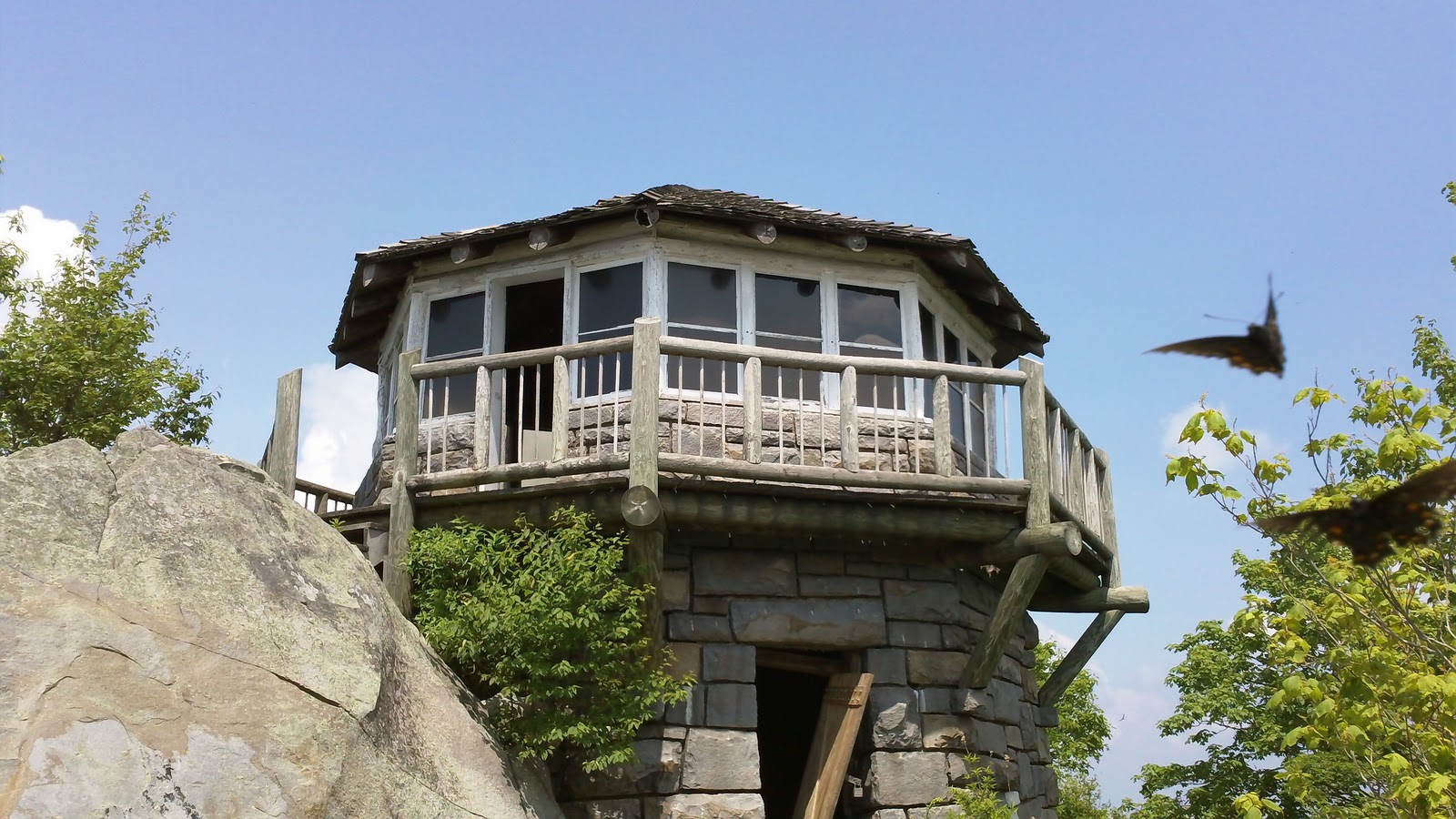
Mt. Cammerer Fire Tower

Smokemont Loop Trail / Bradley Fork
Trailhead: Smokemont Campground
Length: 6.2 miles
Trail Features: Wildflowers and a walk along the Bradley Fork

Russell Field / Spence Field
Trailhead: Anthony Creek Trailhead in the Cades Cove Picnic Area Length: 13.3 miles
Trail Features: Panoramic views from Spence Field, abundant mountain laurel

Wet Bottom / Cooper Road / Hatcher Mountain / Abrams Falls
Trailhead: Cades Cove Visitor Center
Length: 13.4 miles
Trail Features: Abrams Falls, solitude (other than the section to the falls)

Rainbow Falls / Mt. LeConte / Bullhead
Trailhead: Cherokee Orchard Loop
Length: 14.1 miles
Trail Features: Spectacular views from the summit of Mt. LeConte, Rainbow Falls highest falls in park

Lower Mt. Cammerer /Appalachian Trail / Low Gap
Trailhead: Cosby Campground
Length: 15.5 miles
Trail Features: Spectacular views, Historic Mt. Cammerer Fire Tower


North Carolina Side Loop Hikes

Goldmine Loop Trail
Trailhead: Lakeshore Drive Tunnel
Length: 3.8 miles
Trail Features: Fontana Lake, remains of an old home site
Twentymile Trail / Twentymile Loop / Wolf Ridge
Trailhead: Twentmile (west of Fontana Village)
Length: 7.6 miles
Trail Features: Mountain streams and a small waterfall

Caldwell Fork / Boogerman Trail
Trailhead: Cataloochee Campground
Length: 7.4 miles
Trail Features: Old growth forest, picturesque streams and falls, and the remains of early settler's home sites
Shuckstack Fire Tower

Cooper Creek / Deeplow Gap / Thomas Divide / Mingus Creek
Trailhead: Cooper Creek Trailhead (north of Ela, NC)
Length: 11.1 miles
Trail Features: Waterfalls and sporadic views of surrounding mountains

Appalachian Trail / Shuckstack / Lost Cove / Lakeshore Trail
Trailhead: Fontana Dam
Length: 12 miles
Trail Features: Shuckstack Fire Tower, spectacular views of Fontana Lake, remnants of old home sites

Hemphill Bald / Caldwell Fork / Rough Fork
Trailhead: Polls Gap (near Balsam Mountain Campground)
Length: 13.7 miles
Trail Features: Outstanding views of the Cataloochee Valley