The Smoky Mountain Hiking Blog: Great Smoky Mountains is Top Money Generating National Attention: According to a recently-released National Park Service (NPS) study, Great Smoky Mountains National Park is not only the nation's most visited national park, it also tops the 397 national park units in visitor spending. The study estimates that in 2010 the Park's 9 million visitors spent over $818 million in the gateway communities surrounding the Park. The study also estimates that 11,367 local jobs were supported by Park visitor spending.The study, "Economic Benefits to Local Communities from National Park Visitation and Payroll, 2010", was conducted by Dr. Daniel Stynes of the Department of Community, Agriculture, Recreation and Resource Studies at Michigan State University. According to Stynes' study the National Park Service received 281 million recreational visits in 2010 and park visitors spent $12.13 billion in local gateway regions.The study provides a park-by-park and state-by-state breakdowns of each park unit's visitation, visitor spending, and local jobs supported at NPS units from Alaska to the Virgin Islands. The top five NPS units in terms of spending generated were:1) Great Smoky Mountains National Park (TN/NC) with $818 million2) Grand Canyon (AZ) at $415 million3) Yosemite (CA) with $354 million4) Yellowstone (MT/WY/ID) at $334 million5) Blue Ridge Parkway (VA/NC) with $299 millionDale Ditmanson, Smokies Superintendent, said, "This study clearly demonstrates the economic benefits that communities located near national parks receive by being collocated with these unique national, historic and cultural sites."
Monday, January 30, 2012
Appalachian Trail Conservancy Launches “Lodging Give Back
The Smoky Mountain Hiking Blog: Appalachian Trail Conservancy Launches “Lodging Give Back: The Appalachian Trail Conservancy (ATC) recently announced a new program that offers travelers the opportunity to help support the Appalachian Trail by staying at select lodges. The program, called “Lodging Give Back”, was announced on January 20th at the Bavarian Inn and Restaurant in Shepherdstown, WV, during the retirement celebration of David Startzell, ATC’s Executive Director. The Bavarian Inn will serve as the first establishment to offer this “giving back” program to its patrons.“The Appalachian Trail Conservancy is thrilled to have the opportunity to partner with businesses like the Bavarian Inn to help spread awareness and raise support for the Appalachian Trail”, said Amy McCormick, Corporate and Foundation Manager of the ATC.The program offers the opportunity for hotels, inns, and bed & breakfasts along the A.T. to donate a portion of their sales to support ATC’s mission. Patrons will have the option to donate a part of their stay to help support the ATC and maintainer club efforts in order to conserve the footpath, viewsheds, and environmental & cultural resources along the A.T.
Saturday, January 28, 2012
How To Choose Trekking Poles
Two sticks are better than one on the trail. Using a pair of hiking poles or trekking poles gives you balance and takes more stress off the lower body joints. The poles are designed to provide extra stability and to spread the load on your legs and on your arms. You end up in better shape since the poles burn additional calories. The grips and straps are designed so you can push down on them to assist yourself on the trail, but also for quick release if the pole gets stuck between rocks or roots. Always try to use the hiking poles in a store or use a demo model outdoors if it is at all possible.
What type of grip?There are many types of grips: Rubber, Cork, Plastic and a new Foam material. Plastic is the least expensive and not very practical or efficient. Rubber is more expensive than the plastic grip and is efficient. The rubber grip will be a little colder than the cork grip, more tiring and will become slippery due to sweaty hands. The cork grip is the most efficient, warmer, not slippery, is very comfortable and is the most expensive. Try all types of grips to determine which grip is the best for you. Some hiking poles have an extra section for the grip underneath the grip so that you can shorten the length of the poles by just gripping the poles below the grip (so you don't have to shorten the poles each time).
What angle for the grip?Most of the hiking poles are straight, but some have a grip that has an angle of about 15 degrees. The angled grip is supposed to help your wrist from getting tired and overused since your wrist does not go back and forth when hiking. I have not used the angled grip so I do not have an opinion on that type of model. The straight grips are the most popular (and less expensive), but try them both to see if the angled pole is right for you.
What type of strap and grip?Grip and strap designs differ for the type of activity you are doing (fitness walking or hiking). Select the grip and strap to match your activity. Check to make sure that the strap is easily adjusted, even with heavy gloves on. You don't want to have to remove your gloves on a very cold day to start adjusting your straps. A quick-release mechanism for the strap is very useful for emergencies.
Adjustable or non-adjustable height poles?If you are using your hiking poles for hiking and not for a walk in the park, your poles must be adjustable. If you are not sharing your poles with anyone and the walks are flat, then you can use the non-adjustable height poles. Adjustable hiking poles either have 2 or 3 adjustable sections. The 3 section hiking poles collapse into a smaller length (good for traveling and storing in your backpack). Each manufacturer has a unique type of mechanism to adjust the height of the hiking pole. Take the pole apart and look at how the locking device functions. Make sure you can adjust the length of the hiking poles with your heavy gloves on if you need to when it is cold outside. If you want to be safe, purchase an extra locking mechanism for safety reasons when you are using your poles.
Anti-shock or no shock system?When the pole hits the ground, the anti-shock system in the pole can reduce the shock. Some poles actually use a spring in each pole to act as shock absorber. The anti-shock system will weigh more, so if weight is a factor, choose the poles that have no shocks. But the anti-shock system can increase your comfort in using the poles. Make sure the poles that you choose can turn the shocks on or off.
The tips and baskets?There are usually at least 2 or 3 types of baskets for hiking poles: smaller baskets for hiking on dirt, sand, rocks, etc., a large baskets for snow and the largest basket for deep powder snow. The larger baskets will keep the hiking poles from sinking deeply in the snow. There is usually a carbide tip on the hiking pole. Make sure the tip can be replaced by you if it is broken accidentally. Usually there will also be rubber tips available to place over the carbide tip if you just want to go for a walk on the sidewalk or on pavement. Make sure the baskets can be changed, too.
How to Choose Hiking & Trekking Poles - Courtesy of Trails.com
Friday, January 27, 2012
Advantages of Using Trekking Poles
•They provide better balance and footing.
•On downhill hikes especially, they decrease the amount of stress on your legs and joints.
•On uphill climbs, poles transfer some of your weight to your shoulders, arms and back, which can reduce leg fatigue and add thrust to your ascents.
•They make crossing streams, loose rocks and slippery surfaces such as ice and snow patches easier and safer.
•They help you establish a walking rhythm.
•They can push back overhanging vegetation from the trail and probe soggy terrain for holes and boggy spots.
Trekking poles are most helpful to those with weak or damaged knees or ankles, particularly when going downhill, because the poles absorb some of the impact that your body would normally sustain. According to a 1999 study in The Journal of Sports Medicine, trekking poles can reduce compressive force on the knees by up to 25%. This translates into literally tons of weight that your body will not have to support during the course of a regular hike.
It should be noted that using trekking poles will not decrease your overall energy expenditure since you'll be using your arms more than you would when walking without poles. They do, however, help distribute your energy usage in a way that can help your hiking endurance.
Types of Trekking Poles :
Antishock poles: These offer internal springs that absorb shock when you walk downhill. With most poles, this feature can be turned off when it's not needed such as when you're walking uphill. The antishock feature is recommended if you have weak or damaged ankles, knees or hips. It adds a bit to the cost of the poles.
 Standard poles: These do not have the antishock feature and are lighter and less expensive as a result. While they don't absorb as much impact as antishock poles when going downhill, they do provide a similar level of balance and support.
Nordic walking poles: Long established in Europe, Nordic walking is gradually becoming popular in the U.S., too. It's a social activity that offers a total body workout. Nordic walking poles are a modified version of trekking poles. REI does not currently carry poles designed for Nordic walking.
•On downhill hikes especially, they decrease the amount of stress on your legs and joints.
•On uphill climbs, poles transfer some of your weight to your shoulders, arms and back, which can reduce leg fatigue and add thrust to your ascents.
•They make crossing streams, loose rocks and slippery surfaces such as ice and snow patches easier and safer.
•They help you establish a walking rhythm.
•They can push back overhanging vegetation from the trail and probe soggy terrain for holes and boggy spots.
Trekking poles are most helpful to those with weak or damaged knees or ankles, particularly when going downhill, because the poles absorb some of the impact that your body would normally sustain. According to a 1999 study in The Journal of Sports Medicine, trekking poles can reduce compressive force on the knees by up to 25%. This translates into literally tons of weight that your body will not have to support during the course of a regular hike.
It should be noted that using trekking poles will not decrease your overall energy expenditure since you'll be using your arms more than you would when walking without poles. They do, however, help distribute your energy usage in a way that can help your hiking endurance.
Types of Trekking Poles :
Antishock poles: These offer internal springs that absorb shock when you walk downhill. With most poles, this feature can be turned off when it's not needed such as when you're walking uphill. The antishock feature is recommended if you have weak or damaged ankles, knees or hips. It adds a bit to the cost of the poles.
 Standard poles: These do not have the antishock feature and are lighter and less expensive as a result. While they don't absorb as much impact as antishock poles when going downhill, they do provide a similar level of balance and support.
Compact or women's poles: These are shorter and have smaller grips for hikers with smaller hands. They are easier to swing because they weigh less and are also simpler to pack. Youth poles for kids are also available.
Hiking staff: Sometimes called a walking staff or travel staff, this is a single pole that's most effective when used on relatively flat terrain and with little or no load on your back. Hiking staffs are adjustable and some include the antishock feature. They may also include a built-in camera mount under the handle that can be used as a monopod.
Adventures In Stoving: The New MSR MicroRocket -- Completed Review
Adventures In Stoving: The New MSR MicroRocket -- Completed Review: If you've been following my blog at all, you know I've been evaluating the new MicroRocket stove from MSR. The new MSR MicroRocket As a ...
Trail Warnings And Conditions In The Great Smoky Mountains
Trail Cautions . Warnings And Conditions
Please note that the park's backcountry is managed as a natural area where the forces of nature determine trail conditions. The following list includes some conditions that the park is currently aware of. However, hikers may encounter trail conditions not listed below that require caution. Be prepared for swollen streams, bridge washouts, downed trees, and trail erosion when hiking in the park's backcountry.
• Caldwell Fork Trail - several footbridges along the trail are damaged. Hikers wishing to use the trail will need to ford the creek.
• Trails throughout the park, especially those on the western end, have numerous downed trees due to severe wind storms. Please see the list of closed trails above. Other trails may have areas that are difficult to negotiate due to downed trees.
• Boat shuttles to and from Hazel Creek when lake levels are low are from the Ollie Cove Trailhead on the Hazel Creek embayment. Ask the shuttle service about this when making a reservation to be dropped or picked up. This is due to a bridge that is out of service on Hazel Creek and adds about 1/2 mile to the hike. Ollie Cove Trail is new - trail signs are in place to direct you from the Hazel Creek Trail and Lakeshore Trail intersection to Ollie Cove Trail that is one mile east on Lakeshore Trail from Hazel Creek.
Cave and Mine Shaft Closure
Entry into all caves and mine shafts is prohibited due to concerns about the spread of white nose syndrome among bats.
Backcountry Areas Closed
• Backcountry Campsites 3, 11 closed due to tornado damage
• Beard Cane Trail closed due to tornado damage
• Hatcher Mountain Trail North of its intersection with Little Bottoms Trail closed due to tornado damage
• Gunter Fork Trail closed due to landslides
National Park Service Funds Trail Projects in 22 States
The Smoky Mountain Hiking Blog: National Park Service Funds Trail Projects in 22 States: The National Park Service announced today that nearly one million dollars in trail grants will be awarded to 14 trails in 22 states and Washington DC.The 2012 Connect Trails to Parks Awards will provide a total of $934,000 to 14 projects where national historic and scenic trails intersect with national parks and other federal facilities. The projects will restore or improve existing trails and trailhead connections, provide better wayside and interpretive services, encourage innovative educational services, support bridge and trailhead designs, and provide planning services for important trail gateways.Many of the projects reflect National Park Service priorities such as expanding outreach, connecting to youth, enhancing urban recreation, promoting healthy lifestyles, and upgrading interpretive materials as outlined in the agency’s A Call to Action: Preparing for a Second Century of Stewardship and Engagement. In addition to operating 397 parks across the United States and its territories, the National Park Service plays a vital role in overseeing the 52,000-mile National Trails System.The Connect Trails to Parks program is designed to increase awareness, appreciation, and use of the nation’s federally-designated system of trails. The years from 2008 to 2018 have been declared "A Decade for the National Trails" ramping up to the trails system's 50th anniversary in 2018. Many of these projects will help specific trails and their related federal facilities to achieve goals associated with this commemorative decade.
Tuesday, January 24, 2012
The Smoky Mountain Hiking Blog: Appalachian Trail Conservancy Offers Wilderness Fi...
The Smoky Mountain Hiking Blog: Appalachian Trail Conservancy Offers Wilderness Fi...: The Appalachian Trail Conservancy is accepting applications for their Wilderness First Aid Course at the Twin Creeks Science and Education Center in the Great Smoky Mountains National Park near Gatlinburg. The public is welcome to take this training opportunity alongside Appalachian Trail Ridgerunners.This two-day course will be held over February 27th and 28th, and is open to the public at a cost of $150 per person. Overnight accommodations are available at no charge. If you are a day-hiker, backpacker or outdoorsman, this is a great way to be prepared and stay safe. Fast paced and hands-on, the agenda covers a wide range of wilderness medicine topics for people who travel and work in the outdoors.This course is pre-approved by organizations such as the American Camping Association, the United States Forest Service and other governmental agenciesRecommended for: avid hikers, teachers leading school trips, backcountry guides, canoe trip leaders, private expedition groups, college/university outdoor education programs, hiking club trip leaders, wilderness therapeutic programs, and adventure race safety personnel.To enroll or for more information, please contact Andrew Downs with the ATC at 828.254.3708 or adowns@appalachiantrail.org.
Thursday, January 19, 2012
Hike to Spence Field via Leads Cove
The shortest hike to Spence Field is via the Lead Cove Trail. The trail name is supposedly derived from the lead ore that was extracted here in the 1800s.
Towards the beginning of this hike you'll pass an old homestead site on the left. The trail follows along the Sugar Cove Prong for roughly three-quarters of a mile before branching off and climbing steeply up to the Bote Mountain Trail. At 1.8 miles the trail dead-ends into the Bote Mountain Trail. You will have already climbed nearly 1300 feet at this point. To continue on to Spence Field, turn right at this junction.
As you ascend the Bote Mountain Trail you'll be hiking through a fairly open pine-oak forest, with intermittent views of Defeat Ridge towards the left.
At roughly 3 miles the Anthony Creek Trail branches off to the right. Continue going straight here.
As you continue climbing the Bote Mountain Trail, you'll begin walking through a long stretch of trail where the rhododendron forms a tunnel over the trail. You'll also notice that the trail has sunk a couple of feet below the ground on either side of the trail. My guess is that this is a result of a combination of erosion, and the trampling of the sheep and cattle that were driven to and from Spence Field prior to the establishment of the national park.
At roughly 4.7 miles you'll reach the Appalachian Trail, and Spence Field. If you turn right at this junction you’ll pass through a series of small grassy meadows. These are pleasant meadows, but nothing compared to what you'll find on the other side of the junction.
If visibility is good you'll have outstanding views of the North Carolina side of the Smokies. And if you're there in June, you'll have one of the most spectacular displays of mountain laurel found just about anywhere. The hillsides and meadows are literally covered in the white and soft pink flowers from this member of the heath family.
You'll only need to walk 100 yards or so beyond the junction to find a great spot to enjoy a picnic lunch, or just soak in the grand scenery.
Spence Field is named after James Spence who built a cabin in this area in 1830. The History of the Grassy Balds in Great Smoky Mountains National Park, an online book on the Park website, states that neither Russell or Spence Field are natural grassy balds, but were actually cleared by settlers for the purposes of grazing sheep and cattle.
 |
| Hiking to Spence Field via Leads Cove |
 |
| Beautiful sunny day to hike to Spence Field Shelter |
 |
| Just About There ! |
 |
| Spence Field |
 |
| Mountain Laurel |
 |
| Dogwoods at Spence Field |
 |
| Spence Field Shelter |
 |
| Atti at Spence Field Shelter |
 |
| Robin making it's home at Spence Field Shelter |
History Of The Great Smoky Mountains
The Great Smoky Mountains are among the highest peaks in the Appalachian mountain range, yet they are rounder and lower in elevation than younger mountain chains such as the Rocky Mountains. How they came to be this way is a story that began almost one billion years ago.Â
The Great Smoky Mountains are among the highest peaks in the Appalachian mountain range, yet they are rounder and lower in elevation than younger mountain chains such as the Rocky Mountains. How they came to be this way is a story that began almost one billion years ago.
An ancient sea flooded what is now the eastern United States, submerging the remnants of an old mountain range. The sea slowly deposited layers and layers of sediment onto the ocean floor. The intense pressure of thousands of feet of sediment compressed these layers into metamorphic rock. Almost 300 million years ago, the sea added yet another layer of limestone sediment that was composed of fossilized marine animals and shells. The stage was set for the formation of the Appalachian Mountains.

During the ice ages, massive boulders were created by alternating freezing and thawing of the rock. You can see boulder fields on the Cove Hardwood, Noah "Bud" Ogle and Roaring Fork Motor Nature Trails.
The Smokies originally looked more like the Himalayas than the rounded mountains we see today. The relentless erosive force of water has sculpted their present-day appearance. Water runoff has also helped to carve the alternating pattern of V-shaped valleys and steep ridges. Landslides caused by a torrential downpour in 1951 created the large V-slash on Mount LeConte, and rock slides in 1984 briefly closed Newfound Gap Road. As you explore the park, look for how water continues to sculpt the land.
Human History
Evidence of human habitation here goes back at least 11,000 years. They were believed to have been a breakaway group of Iroquois, later to be called Cherokee, who had moved south from Iroquoian lands in New England. The Cherokee Nation stretched from the Ohio River into South Carolina and consisted of seven clans. The Eastern Band of the Cherokee lived (and continue to live) in this sacred ancestral home of the Cherokee Nation.
The Cherokee enjoyed a settled, sophisticated agriculture-based life. Their towns of up to 50 log-and-mud huts were grouped around the town square and the Council House, a large, seven-sided (for the seven clans), dome-shaped building. Public meetings and religious ceremonies were held here. They first encountered Europeans in 1540, when Spanish explorer Hernando de Soto led an expedition through Cherokee territory.
In the late 18th century, Scotch-Irish, German, English and other settlers arrived in significant numbers. The Cherokee were friendly at first, but fought with settlers when provoked. They battled Carolina settlers in the 1760s but eventually withdrew to the Blue Ridge Mountains.
To come to terms with the powerful newcomers, the Cherokee Nation attempted to make treaties and to adapt to European customs. They adopted a written legal code in 1808 and instituted a supreme court two years later. Sequoyah, a Cherokee silversmith, created an alphabet for the Cherokee language and in the space of two years, nearly all of his people could read and write the language. But theirs was a losing cause. The discovery of gold in northern Georgia in 1828 sounded the death knell for the Cherokee Nation.
In 1830, President Andrew Jackson signed the Removal Act, calling for the relocation of all native peoples east of the Mississippi River to Indian Territory, now Oklahoma. The Cherokee appealed their case to the Supreme Court and Chief Justice Marshall ruled in their favor. President Jackson, however, disregarded the Supreme Court decree in the one instance in American history when a U.S. president overtly ignored a Supreme Court decision.
In 1838, the U.S. government forced some 13,000 Cherokee to march to Oklahoma along what has become known as the Trail of Tears. About one-third of the Cherokee died en route of malnutrition and disease. Altogether, about 100,000 natives, including Cherokee, Seminole, Chickasaw and Choctaw survived the journey.
A handful of Cherokee disobeyed the government edict, however. Hiding out in the hills between Clingmans Dome and Mount Guyot, they managed to survive. In 1889, the 56,000-acre Qualla Indian Reservation was chartered with a population of about 1,000 people. Approximately 10,500 of their descendants now live on the reservation, which is located along the park's southern boundary.
Like the Cherokee, pioneers who settled in the Smokies in the 18th and 19th centuries coveted the fertile valleys. Land soon became scarce. Later arrivals made their homesteads along steep slopes.
Logging began slowly, but by the time it ran its course, it had radically changed the land and the life of the people. Timber, of course, was vital to the early pioneers. They used it for homes, furniture, fences and fuel. They only began cutting it for cash in the mid-19th century. This had little noticeable effect on the forest, however, because men and animals could only carry so much.
Not so by the turn of the century. Technological advances and the eastern United States' need for lumber nearly eliminated all the southern Appalachian forests. Railroads were the key to the companies' large-scale logging operations. Railroad tracks reaching deep into the mountains made the timber readily available. Steam-powered equipment such as skidders and log loaders also contributed to cost-effective tree removal.
Some 15 company towns were constructed in what is now the park, along with a like number of sawmills. Mountain people who had once plowed fields and slopped hogs began to cut trees and saw logs for a living, abandoning their farms. They were attracted to logging by the promise of security and the stability of a steady paycheck.
Their security was short-lived, however. By the 1930s, the lumber companies had logged all but the most inaccessible areas and were casting their sights to richer pickings out West. Some of the mountain people returned to farming while others left to seek jobs in mines, textile mills and automobile factories.
National Park Status
In 1904, a librarian from St. Louis named Horace Kephart came to the Smokies for a respite to restore his health. Kephart found that large-scale logging was decimating the land and disrupting the lives of the people. As the years progressed, he promoted preserving the Smokies as a national park. In the 1920s, prominent Knoxville residents took up the cause and formed a citizens' organization.
The NPS was looking for park sites in the East after having established parks in the West. Founded in 1916, the young agency hoped to generate further public support for national parks with a park closer to the majority of the nation's population. Along with private efforts, the NPS promoted the idea of a national park in the Smokies.
The states of Tennessee and North Carolina, and countless citizens responded by giving millions of dollars to purchase parkland. The federal government was reluctant to buy land for parks; national parks in the West had been formed from land it had already owned. Eventually, it did contribute $2 million. Coupled with John D. Rockefeller, Jr.'s donation of $5 million, the NPS reached its goal.
Lumber companies were bought out in agreements that phased out operations over several years and some people living within the proposed park boundaries were allowed lifetime residency rights. Most people moved, and consequently were paid more for their land. On June 15, 1934, Great Smoky Mountains National Park was officially established, preserving the land for generations to come.
Wednesday, January 18, 2012
Loop Hikes In The Great Smoky Mountains ( GSMNP )
Tennessee Side Loop Hikes
Cucumber Gap / Little River Trail
Trailhead: Elkmont
Length: 5.6 miles
Trail Features: Historic Elkmont cottages, wildflowers, hike along stream
Trailhead: Elkmont
Length: 5.6 miles
Trail Features: Historic Elkmont cottages, wildflowers, hike along stream
Finley Cane / Bote Mountain / Lead Cove
Trailhead: Laurel Creek Road (about 5.5 miles from the Townsend "Y"
Length: 7 miles
Trail Features: Quiet walk in woods, old homestead sites and sporadic views of surrounding mountains
Trailhead: Laurel Creek Road (about 5.5 miles from the Townsend "Y"
Length: 7 miles
Trail Features: Quiet walk in woods, old homestead sites and sporadic views of surrounding mountains
Rich Mountain Loop
Trailhead: Main Cades Cove parking area
Length: 8.5 miles
Trail Features: John Oliver cabin, wildflowers, sporadic views of Cades Cove and Tuckaleechee Cove
Trailhead: Main Cades Cove parking area
Length: 8.5 miles
Trail Features: John Oliver cabin, wildflowers, sporadic views of Cades Cove and Tuckaleechee Cove
Deep Creek/Indian Creek/Deep Creek Loop Trailhead: Deep Creek
Length: 4.6 miles
Trail Features: Waterfalls and wildflowers
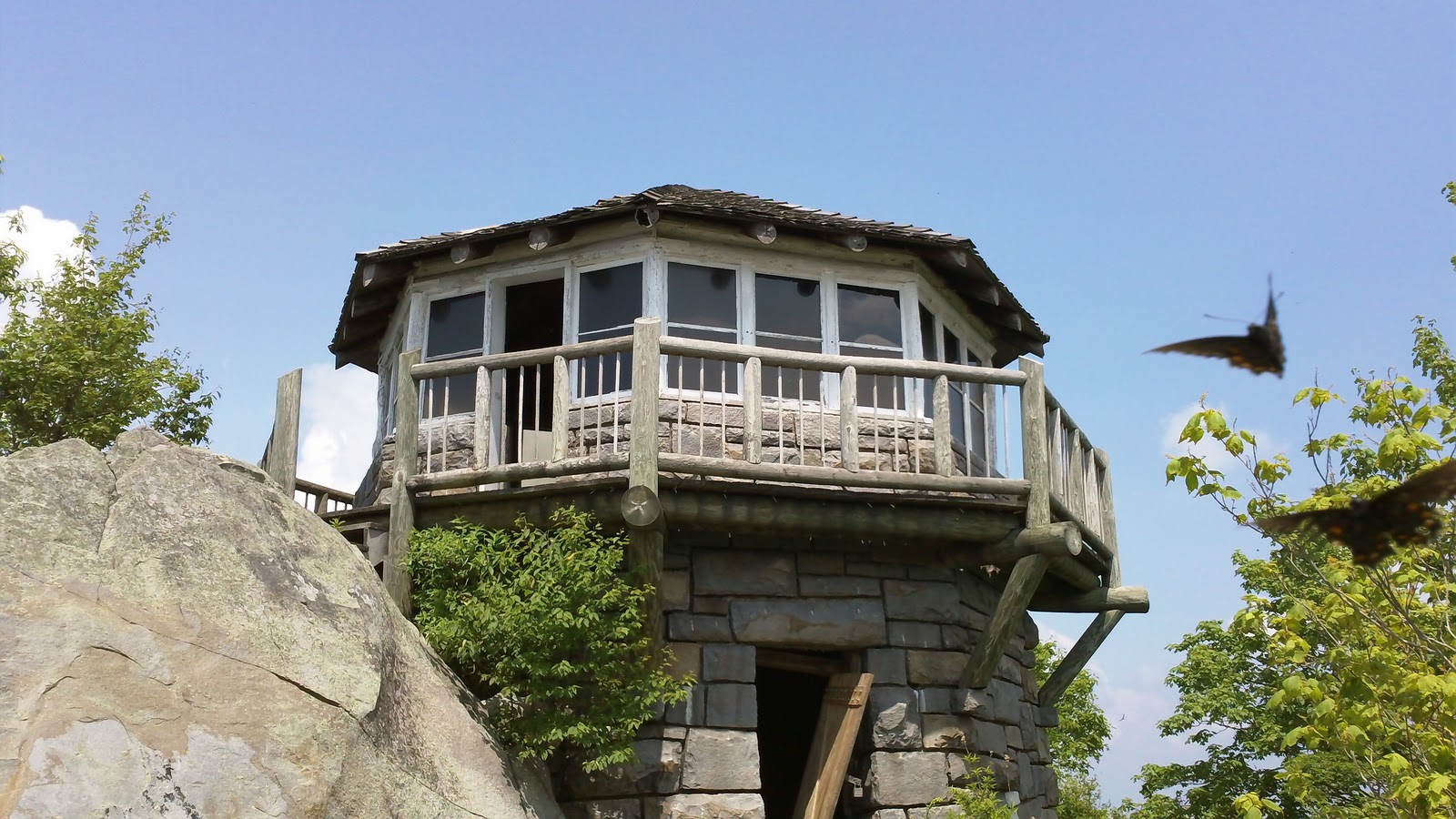 |
| Mt. Cammerer Fire Tower |
Smokemont Loop Trail / Bradley Fork
Trailhead: Smokemont Campground
Length: 6.2 miles
Trail Features: Wildflowers and a walk along the Bradley Fork
Russell Field / Spence Field
Trailhead: Anthony Creek Trailhead in the Cades Cove Picnic Area Length: 13.3 miles
Trail Features: Panoramic views from Spence Field, abundant mountain laurel
Wet Bottom / Cooper Road / Hatcher Mountain / Abrams Falls
Trailhead: Cades Cove Visitor Center
Length: 13.4 miles
Trail Features: Abrams Falls, solitude (other than the section to the falls)
Rainbow Falls / Mt. LeConte / Bullhead
Trailhead: Cherokee Orchard Loop
Length: 14.1 miles
Trail Features: Spectacular views from the summit of Mt. LeConte, Rainbow Falls highest falls in park
Lower Mt. Cammerer /Appalachian Trail / Low Gap
Trailhead: Cosby Campground
Length: 15.5 miles
Trail Features: Spectacular views, Historic Mt. Cammerer Fire Tower
North Carolina Side Loop Hikes
Goldmine Loop Trail
Trailhead: Lakeshore Drive Tunnel
Length: 3.8 miles
Trail Features: Fontana Lake, remains of an old home site
Twentymile Trail / Twentymile Loop / Wolf Ridge
Trailhead: Twentmile (west of Fontana Village)
Length: 7.6 miles
Trail Features: Mountain streams and a small waterfall
Trailhead: Lakeshore Drive Tunnel
Length: 3.8 miles
Trail Features: Fontana Lake, remains of an old home site
Twentymile Trail / Twentymile Loop / Wolf Ridge
Trailhead: Twentmile (west of Fontana Village)
Length: 7.6 miles
Trail Features: Mountain streams and a small waterfall
Caldwell Fork / Boogerman Trail
Trailhead: Cataloochee Campground
Length: 7.4 miles
Trail Features: Old growth forest, picturesque streams and falls, and the remains of early settler's home sites
 |
| Shuckstack Fire Tower |
Cooper Creek / Deeplow Gap / Thomas Divide / Mingus Creek
Trailhead: Cooper Creek Trailhead (north of Ela, NC)
Length: 11.1 miles
Trail Features: Waterfalls and sporadic views of surrounding mountains
Appalachian Trail / Shuckstack / Lost Cove / Lakeshore Trail
Trailhead: Fontana Dam
Length: 12 miles
Trail Features: Shuckstack Fire Tower, spectacular views of Fontana Lake, remnants of old home sites
Hemphill Bald / Caldwell Fork / Rough Fork
Trailhead: Polls Gap (near Balsam Mountain Campground)
Length: 13.7 miles
Trail Features: Outstanding views of the Cataloochee Valley
Facts about The Great Smoky Mountain National Park ( GSMNP )
Formed roughly 200-300 million years ago, the Great Smoky Mountains are among the oldest mountains in the world. Today, the park bearing the name of these mountains encompasses more than 541,000 acres (more than 800 + square miles). Just over half of this landmass lies within the state of North Carolina, with the rest in Tennessee.
The Great Smoky Mountains National Park receives more than 9.5 million visitors a year, making it the most visited national park in the country. The Grand Canyon, the second most visited national park, receives roughly 4.4 million visitors per year!
June, July, August and October are the most popular months for visitors. The park sees more than a million visitors during each of these months.
Although the Smokies may seem overcrowded with these kinds of numbers, it's still easy to escape civilization. The park boasts more than 800 miles of trails, including roughly 74.5 miles of the Appalachian Trail which runs along the crest of the Smokies. Yes, there are a few trails with extreme crowds during the summer, but these are usually the shorter trails near Gatlinburg, Cades Cove or along Newfound Gap Road. Go to the more remote sections of the park, or take a longer trail, and you're likely to find virtual solitude.
Hikers will find that trails in the Smokies offer a great amount of diversity. For one, elevation in the park ranges from 840 feet at the mouth of Abrams Creek on the western edge of the park, to 6643 feet at the summit of Clingmans Dome. There are also more than 2100 miles of streams in the park, making for numerous fishing opportunities, picnic spots, or even a swimming hole during a hot summer afternoon.
 The Smokies are home to more than 1600 species of flowering plants. During the spring, wildflowers explode during the brief window prior to trees leafing out and shading the forest floor (from about mid-April thru mid-May). During the early summer period (from about mid-June to mid-July), awesome displays of mountain laurel, rhododendron, flame azalea, and other heath family shrub flowers can be enjoyed, especially on the higher elevation balds. For Catawba rhododendron, take the relatively short hike to Andrews Bald. Although somewhat of a long trek, hikers going to Gregory Bald will be amply rewarded by the exceptional displays of flame azalea at the summit. Finally, Spence Field is by far the best place for mountain laurel.
There are 66 species of mammals, including black bears, elk, fox, bobcats, coyotes, and river otter that live within the park borders. Based on a study conducted in 2006, biologists estimate that approximately 1,500 black bears live in the park, a density of approximately two bears per square mile. This National Park link will provide you with a better understanding of bear behavior and what to do if you see one on the trail.
Additionally, there are over 245 varieties of birds, 83 native fish species, and more than 80 types of reptiles and amphibians (data is from the All Taxa Biodiversity Inventory).
Other key facts about Great Smoky Mountains National Park:* Great Smoky Mountains National Park was established in 1934.
* The Great Smoky Mountains is one of the only major national parks that doesn't charge an entrance fee.
* There are three visitors centers located within the park: Sugarlands (Gatlinburg), Cades Cove, and Oconaluftee (Cherokee, NC).
* There are 10 campgrounds with a total of 1000 sites within the park boundaries. Additionally, there are more than 100 backcountry campsites, including shelters.
* The park maintains 78 historic structures located in five historic districts.
* The park was designated as an International Biosphere Reserve by the United Nations on October 26, 1976. It was also designated a World Heritage Site on December 6, 1983.
* In the Smokies, the average annual rainfall varies from approximately 55 inches in the valleys, to over 85 inches on some peaks, more than anywhere else in the country except the Pacific Northwest. During the wettest years, over eight feet of rain can fall in the high country.
The Great Smoky Mountains National Park receives more than 9.5 million visitors a year, making it the most visited national park in the country. The Grand Canyon, the second most visited national park, receives roughly 4.4 million visitors per year!
June, July, August and October are the most popular months for visitors. The park sees more than a million visitors during each of these months.
Although the Smokies may seem overcrowded with these kinds of numbers, it's still easy to escape civilization. The park boasts more than 800 miles of trails, including roughly 74.5 miles of the Appalachian Trail which runs along the crest of the Smokies. Yes, there are a few trails with extreme crowds during the summer, but these are usually the shorter trails near Gatlinburg, Cades Cove or along Newfound Gap Road. Go to the more remote sections of the park, or take a longer trail, and you're likely to find virtual solitude.
Hikers will find that trails in the Smokies offer a great amount of diversity. For one, elevation in the park ranges from 840 feet at the mouth of Abrams Creek on the western edge of the park, to 6643 feet at the summit of Clingmans Dome. There are also more than 2100 miles of streams in the park, making for numerous fishing opportunities, picnic spots, or even a swimming hole during a hot summer afternoon.
 The Smokies are home to more than 1600 species of flowering plants. During the spring, wildflowers explode during the brief window prior to trees leafing out and shading the forest floor (from about mid-April thru mid-May). During the early summer period (from about mid-June to mid-July), awesome displays of mountain laurel, rhododendron, flame azalea, and other heath family shrub flowers can be enjoyed, especially on the higher elevation balds. For Catawba rhododendron, take the relatively short hike to Andrews Bald. Although somewhat of a long trek, hikers going to Gregory Bald will be amply rewarded by the exceptional displays of flame azalea at the summit. Finally, Spence Field is by far the best place for mountain laurel.
There are 66 species of mammals, including black bears, elk, fox, bobcats, coyotes, and river otter that live within the park borders. Based on a study conducted in 2006, biologists estimate that approximately 1,500 black bears live in the park, a density of approximately two bears per square mile. This National Park link will provide you with a better understanding of bear behavior and what to do if you see one on the trail.
Additionally, there are over 245 varieties of birds, 83 native fish species, and more than 80 types of reptiles and amphibians (data is from the All Taxa Biodiversity Inventory).
Other key facts about Great Smoky Mountains National Park:
* The Great Smoky Mountains is one of the only major national parks that doesn't charge an entrance fee.
* There are three visitors centers located within the park: Sugarlands (Gatlinburg), Cades Cove, and Oconaluftee (Cherokee, NC).
* There are 10 campgrounds with a total of 1000 sites within the park boundaries. Additionally, there are more than 100 backcountry campsites, including shelters.
* The park maintains 78 historic structures located in five historic districts.
* The park was designated as an International Biosphere Reserve by the United Nations on October 26, 1976. It was also designated a World Heritage Site on December 6, 1983.
* In the Smokies, the average annual rainfall varies from approximately 55 inches in the valleys, to over 85 inches on some peaks, more than anywhere else in the country except the Pacific Northwest. During the wettest years, over eight feet of rain can fall in the high country.
The Smoky Mountain Hiking Blog: Tree work to close Wears Gap Road this week
The Smoky Mountain Hiking Blog: Tree work to close Wears Gap Road this week: ...Great Smoky Mountains officials announced today on their Temporary Road and Facilities Closures page that Wears Gap Road will be closed this Thursday and Friday (Jan 19-20) for tree and brush removal. The project will improve sight distance around narrow curves and help with visibility of road signs.The secondary entrance connects US 321 in Wears Valley to Little River Road, roughly nine miles west of Gatlinburg.This morning's update also mentioned two other temporary road closures:• Old NC-284 between Big Creek and Cataloochee is closed due to ice and snow.• Forge Creek Road in Cades Cove is closed due to mud.
Tuesday, January 17, 2012
Gregory Z-30 Backpack
Gregory's Z30 is a breathable light weight backpack that has a breathable mesh back that is light weight and comes in two different colors .
Monday, January 16, 2012
Damascus Among 10 Coolest Small Towns in America
The Smoky Mountain Hiking Blog: Damascus Among 10 Coolest Small Towns in America: Readers of Budget Travel Magazine nominated a record 647 towns to be considered among the Coolest Small Towns in America. The magazine has narrowed that list down to just 10 standout communities across the country. Making that list is none other than Trail Town, USA, officially known as Damascus, Virginia.Here's what the online mag had to say about Damascus:It calls itself Trail Town, USA, and the title is no hyperbole. In addition to the fact that Damascus’s main street runs on top of the Appalachian Trail, the town serves as a crossroads for a half-dozen wilderness and cultural pathways. The town commemorates its unique location with an annual Trail Days celebration in the spring that gathers hikers and other outdoorsy types for three days of free concerts, film screenings, and, of course, guided hikes. For tired travelers looking for a touch of comfort, the 12-room Damascus Old Mill overlooks Laurel Creek and is a stone’s throw from the Virginia Creeper Trail—no one rests for long around these parts! For an extra pick-me-up, there’s always Mojoe’s Trailside Coffee, whose “trail magic” drink mixes espresso, ice cream, and caramel into a sweet concoction for a burst of quick energy.Budget Travel failed to note that Damascus also makes for a great base camp for excursions into the Mt. Rogers National Recreation Area, or to check out the wild ponies of Grayson Highlands State Park, or to one of my all time favorite hikes, the A.T. to the summit of Mt. Rogers.You can read about each of the towns that made the final cut, and then vote for your favorite to become America's Coolest Small Town by clicking here. You can vote once daily until the contest closes on January 31st. As of right now, with nearly 87,000 votes cast, Damascus sits in fifth place. Hammondsport, NY is currently in the lead.
Sunday, January 15, 2012
Tips For Hiking Alone
Know the area. People take for granted how much they know about the natural environment in which they live. Odds are, you can identify the poisonous vegetation in your area, are familiar with what kinds of wild animals you might run into, and know how extreme the temperatures can get. So if you’re going to start hiking by yourself, it’s best to do so near your hometown. Even better, try a place you’ve visited before with friends. You’ll be surprised at how different things look on your own.
 Tell someone of your whereabouts. Be sure to check in with a friend about where you’re going, and when you plan on getting home. (Don’t forget to call them when you get back – you don’t want to leave them worrying, do you?) In case something does happen (of course it won’t, but if it does) someone will know right away that you’re missing. Once you’ve told someone where you’re headed, stick to that plan! No changing your mind at the last minute and taking a different trail.You want everyone to have an accurate idea of where you are, so that help can find you if you need it.
Check in at the ranger station. This is always a good idea. Whenever you go on a hike, be sure to stop by the ranger’s station. Give them your name, and let them know that you’ll be hiking alone. Tell them that you’ll check in again on your way out. (Once again, don’t forget to do so!) Be sure to clear your hiking route with the park rangers – they will know which trails are open, and which are the best (and safest) for solo hikers.
Read the weather report. I near the Great Smoky Mountains , where we have a saying: If you don’t like the weather, wait 5 minutes. I’ve literally seen a sky go from sunny and cloudless to dark and hailing in about 15 minutes. Fortunately, I was inside at the time. But if you’re hiking and the weather turns foul, odds are you won’t have time to get yourself back to your vehicle or to a ranger station without getting soaked first. So check the weather report before you leave, and pay attention to the sky – and your fellow hikers. If everyone else is headed back to their cars, that’s a sign that you should, too.
Choose a busy trail. Trails that see lots of foot traffic are better-maintained and safer than more secluded ones. Plus you’re bound to run into a few other explorers, so if you need it, help will just be a few shouts away. Don’t worry that your alone-time will be interrupted – even on popular trails, you might pass a lot of people, but I can guarantee that few will stop to chat – after all, they’re hiking.
Know your limitations. If you rarely work out and get winded walking to the mailbox and back, then maybe you shouldn’t commit to a seven-mile hike. Err on the side of caution and remember that fatigue can creep up on you. Try a neighborhood hike first, to see what you’re able to do and how quick your pace is. This will better help you gauge your abilities (and your time) when you go out alone in the woods.
Stick to the path. It seems like most disastrous hiking stories begin when someone willingly takes a wrong turn. However tempting it might be, don’t wander off the trail and into the woods. Your trampling could cause a lot of damage to plant and animal life. Even worse, you could step onto unstable ground (think rock slides or avalanches). Not only is going off-trail dangerous (because, let’s face it, you will get lost), it’s also illegal in many national parks.
Bring supplies. Always bring the following with you: a sweater, a snack, a map, a first-aid kit, and more water than you think you’ll need. When you’re alone, you won’t have anyone else to mooch off of. And convenience stores aren’t exactly easy to come by when you’re in the middle of the woods. Be responsible: stay hydrated, keep your blood-sugar up, and take care not to get too cold or too over-heated. Since you’re on your own, it’s up to you to take care of yourself.
Make sure your vehicle is up to it. There’s nothing worse than returning from a hike to the comfort of your vehicle to find the engine is dead. Or worse still, not getting to your hike at all because your car died on the way. And since a lot of hiking areas are away from the city, on rural roads that don’t see a lot of traffic, you could be in a lot of trouble if your car breaks down. So make sure that your vehicle is up to the task – whether it’s dirt roads or highway driving – and will get you where you need to go and back home again, safely.
Saturday, January 14, 2012
The Adventure Hiker Speaks: Two of my favorite White Mountain hiking books!
The Adventure Hiker Speaks: Two of my favorite White Mountain hiking books!:
I just love Haunted Hikes of New Hampshire. I used this book on many of my adventures this past summer hiking. Plan on using it again for the adventures I will be going on! It's a little spooky but the trails to follow and what you will find along your journey will be fun! The book itself is a great read and I couldn't put it down, found myself reading them over and over. I grew up here in NH and new a few of the Tales, but these are spooky and soooo interesting! The book is $12.95! Worth the buy!
I just love Haunted Hikes of New Hampshire. I used this book on many of my adventures this past summer hiking. Plan on using it again for the adventures I will be going on! It's a little spooky but the trails to follow and what you will find along your journey will be fun! The book itself is a great read and I couldn't put it down, found myself reading them over and over. I grew up here in NH and new a few of the Tales, but these are spooky and soooo interesting! The book is $12.95! Worth the buy!
The Smoky Mountain Hiking Blog: Record-Level Attendance Continues at NC State Park...
The Smoky Mountain Hiking Blog: Record-Level Attendance Continues at NC State Park...: Visitation at North Carolina’s state parks and state recreation areas continued at a record level in 2011, with 14.25 million visits, matching the all-time record set in 2009 and posting a slight increase from 14.19 visits in 2010, according to the N.C. Division of Parks and Recreation.Among 39 state parks and state recreation areas, 15 reported increases in attendance in 2011. Jockey’s Ridge State Park in Dare County reported the highest attendance at 1.32 million visits, down slightly from 1.47 million last year.A 2008 economic study revealed that travelers spend an average of $23.56 a day to enjoy the state parks. The analysis by North Carolina State University’s Department of Parks, Recreation and Tourism Management estimated the state parks system’s total annual economic impact at more than $400 million. The complete study can be found here.During the past 25 years, the state parks system has seen a dramatic 102 percent increase in visitation. In 1986, 7 million people visited state parks and state recreation areas.Several state parks that reported higher attendance in 2011 were able to offer new amenities to visitors. A new 700-foot swim beach and picnic area at Lake James State Park opened for its first full season, and the park experienced a 70 percent jump in visitation. Improvements at other state parks contributed to increased visitation, including a renovated marina at Carolina Beach State Park, a new equestrian trail network at Medoc Mountain State Park and a number of hiking trail projects, including a volunteer-built summit trail at Elk Knob State Park.The state parks system manages more than 215,000 acres within state parks, state recreation areas and a system of state natural areas dedicated to conservation of rare resources. Through its New Parks for a New Century initiative, six new state parks have been added to the system since 2003.Parks with significant increases in visitation include Dismal Swamp State Park in Camden County (34 percent), Elk Knob State Park in Watauga County (50 percent), Jones Lake State Park in Bladen County (26 percent), Kerr Lake State Recreation Area in Vance County (24 percent) and Medoc Mountain State Park in Halifax County (31 percent). State park visitation is often affected by weather events. For instance, Hurricane Irene in August closed Goose Creek State Park for several weeks and other eastern and Piedmont parks briefly.
Thursday, January 12, 2012
Getting prepared for your Spring Hikes
1. Make sure your ready for it : If you haven't done any winter hiking or stayed in shape at the gym this winter you might want to make your first couple of spring hikes shorter ones. No need to over do it on your first hike or to hurt your self , pull a muscle or something even worse .
2. Check your gear : Again sometimes if you don't winter hike things get misplaced or kids get into your pack to borrow things or just pull things out ( you know kids ! ) Make sure your restocked and everything is in your pack that you will need for your hikes
3. Inspect your Hiking shoes/boots : I know this goes along with checking your gear but so many will neglect the most important thing that gets you where your going. Always make sure laces are in great shape . That their are no holes or rips in your sole . Also check that their are no spiders or bugs that have made your hiking boots their home. Also check for mold ( if your last hike was a rainy one this can happen )
4. Battery Check : Check your batteries in your GPS , Headlamp , Camera and flashlight ( especially if you don't do any winter hiking )
5. Your pack has all your gear : Rain gear , Emergency gear , First Aid kit , Food , extra set of clothes in case of down pour or climate change .
6. Leave an Itinerary : Always let someone know where your going and what time you should be back down the mountain . Especially if your hiking alone like i often do . Also set a time that if no one has heard from you that they call the authorities or park rangers .
7. Plan out your Hike : I usually do this the night before to double check the mileage and the route i have to take driving there . Also check the terrain and the elevation changes especially if it is a new hike .
8. Check the Weather : Always be aware of the weather conditions when your hiking . They can change in just 5 minutes in the mountains especially in the spring and the fall . I have started a hike at the bottom where the temperature was 56 and got to the top and it was snowing and 29 . So always be prepared .
9. Be Aware on the Trail : In the spring you can have many different conditions on the trails . You can have muddy conditions from spring rains then at higher elevations you can run into black ice on rocks during creek crossings or river crossings . Always be alert always be cautious conditions can and will change on you . Wear hiking boots with good tread for better traction during the spring . It is always better to be safe than sorry .
10. Leave No Trace : Always pack out your trash . Leave the beauty of the wilderness the exact way you found it . You wouldn't want a bunch of strangers coming into your back yard to dump their trash so don't dump your trash in someone else's back yard . Show some respect to others who will use the same trails and parks as you .
Wednesday, January 11, 2012
The Smoky Mountain Hiking Blog: Free Admission to All National Parks from January ...
The Smoky Mountain Hiking Blog: Free Admission to All National Parks from January ...: The National Park Service announced yesterday that all 397 national parks across the country will offer free admission from January 14 through 16 to commemorate Dr. Martin Luther King, Jr. Day.Additionally, several parks will be holding special events to honor Dr. King over the three-day weekend.The National Park Service will also waive admission fees on 14 other days in 2012:– National Park Week (April 21 to 29)- Get Outdoors Day (June 9)- National Public Lands Day (September 29)- Veterans Day (November 10 to 12)
The Smoky Mountain Hiking Blog: Oh, Shenandoah!
The Smoky Mountain Hiking Blog: Oh, Shenandoah!: Oh, Shenandoah! is a photographic exhibition celebrating Shenandoah National Park that will open this Thursday at The Arts Center In Orange,...
Hiking In Thunderstorms
Hikes to peaks need to start early, so you can get to the top and get back down before the afternoon clouds build up.
During a lightning storm stay in a section of forest of trees the same height, not on a ridge, not under the tallest trees, not in a cave, under a rock overhang, leaning against a tree or standing on the exposed roots of a tree.
 If caught out in an open area (you saw the clouds forming, and you had plenty of time to get to a safe place--what are you doing there?), spread everybody far apart and crouch down (don't lie down). Keep your feet close together. Keep your hands off the ground. Do not lie flat on the ground!!
This position includes squatting (or sitting) and balling up so you are as low as possible without getting prone. Wrap your arms around your legs, both to offer a safer path than your torso for electrons to flow from the ground, and to add enough comfort that you will choose to hold the position longer.Keep your feet together so you don't create potential for current to flow in one foot and out the other ... current may spontaneously trigger your leg muscles to jump while in the lightning position, so take care to avoid being near hazards when you drop into this position.
Crouch on something insulating if possible, such as your ensolite sleeping pad, or climbing rope. Even dry moss or grass or a snow patch is better than bare rock. Especially if you have to sit instead of crouch, get some insulation under your buttocks.
Get metal objects away from you (they don't attract lightning but they carry induced currents which, although they are small, can add to ground currents and make the difference between getting zapped a little and getting zapped too much or burnt. A woman's watch was burned to her wrist in one instance.)
Stay out of small depressions. Pick a slight rise instead. Not in standing water or a puddle.
Hey! Spread out your group so you aren't all hit at once
But mostly, pick a place quickly and get down, and stay down.
Estimating the Distance from a Thunderstorm
Because light travels much faster than sound, lightning flashes can be seen long before the resulting thunder is heard. Estimate the number of miles you are from a thunderstorm by counting the number of seconds between a flash of lightning and the next clap of thunder. Divide this number by five.
Treatment Principles
· Scene Safety: Avoid further injury to survivors, rescuers, and the patient. You may have to wait for the storm to pass to treat
some patients if they are in extremely hazardous locations.
· Basic Life Support: Rescuers should be prepared to provide prolonged rescue breathing.
· Triage: Unlike normal triage protocols in multi-casualty situations, attend first to those who are in cardiac or respiratory arrest
without obvious lethal injury.
· Assessment: All patients require a complete body survey and careful evaluation for head, spinal, long bone, or cardiac injuries.
Peripheral pulses, and sensory and motor status, should be assessed. Check the skin for small hidden burns.
· Monitor closely for cardiovascular, respiratory and neurological collapse.
· Evacuate any patient obviously injured by lightning, and be alert for lingering physical or neurological issues from exposure to
lightning that should be evacuated for further evaluation and treatment.
During a lightning storm stay in a section of forest of trees the same height, not on a ridge, not under the tallest trees, not in a cave, under a rock overhang, leaning against a tree or standing on the exposed roots of a tree.

This position includes squatting (or sitting) and balling up so you are as low as possible without getting prone. Wrap your arms around your legs, both to offer a safer path than your torso for electrons to flow from the ground, and to add enough comfort that you will choose to hold the position longer.Keep your feet together so you don't create potential for current to flow in one foot and out the other ... current may spontaneously trigger your leg muscles to jump while in the lightning position, so take care to avoid being near hazards when you drop into this position.
Crouch on something insulating if possible, such as your ensolite sleeping pad, or climbing rope. Even dry moss or grass or a snow patch is better than bare rock. Especially if you have to sit instead of crouch, get some insulation under your buttocks.
Get metal objects away from you (they don't attract lightning but they carry induced currents which, although they are small, can add to ground currents and make the difference between getting zapped a little and getting zapped too much or burnt. A woman's watch was burned to her wrist in one instance.)
Stay out of small depressions. Pick a slight rise instead. Not in standing water or a puddle.
Hey! Spread out your group so you aren't all hit at once
But mostly, pick a place quickly and get down, and stay down.
Estimating the Distance from a Thunderstorm
Because light travels much faster than sound, lightning flashes can be seen long before the resulting thunder is heard. Estimate the number of miles you are from a thunderstorm by counting the number of seconds between a flash of lightning and the next clap of thunder. Divide this number by five.
Treatment Principles
· Scene Safety: Avoid further injury to survivors, rescuers, and the patient. You may have to wait for the storm to pass to treat
some patients if they are in extremely hazardous locations.
· Basic Life Support: Rescuers should be prepared to provide prolonged rescue breathing.
· Triage: Unlike normal triage protocols in multi-casualty situations, attend first to those who are in cardiac or respiratory arrest
without obvious lethal injury.
· Assessment: All patients require a complete body survey and careful evaluation for head, spinal, long bone, or cardiac injuries.
Peripheral pulses, and sensory and motor status, should be assessed. Check the skin for small hidden burns.
· Monitor closely for cardiovascular, respiratory and neurological collapse.
· Evacuate any patient obviously injured by lightning, and be alert for lingering physical or neurological issues from exposure to
lightning that should be evacuated for further evaluation and treatment.
Tuesday, January 10, 2012
Hiking In The Rain
1. Waterproof stuff sacks are the way to keep dry clothes dry. Use different-colored sacks so you can easily identify where your gear is stashed. Garbage bags work as liners for non-waterproof sacks.
2. Self-locking plastic bags keep everything dry, from your food supplies to your journal, your matches, camera, first aid kit, guidebook, maps, and firestarter—among other things.
3. In hot climates, it can be pleasant to walk in the rain without rain gear, but if you start feeling cold, it’s time to gear up. Keep a slow, steady pace. You don’t want to overheat.
4. Be prepared by having an extra layer of clothes available where you can get to them fast in case of a sudden change in the weather.This is very important especially in higher elevations.
5. Be flexible about stopping for breaks. In intermittent wet weather, take advantage of dry stretches to eat and drink—regardless of whether it’s your usual time. You’re burning a lot of calories walking and staying warm, and you need to replenish them.
6. Ventilation can regulate your temperature. If your rain gear has “pit zips”, open and close them to cool off or warm up.
7. To keep your feet dry, put on your rain pants. These direct the flow of water past your legs, over the waterproof outsides of your boots. If it’s too warm, gaiters will keep your feet dry for awhile, but won’t keep the rain from going in the tops of your boots.
8. Keep snacks handy in a waistpouch or somewhere else where you don’t have to take off your rain cover, open your pack, and expose your gear to the weather every time you want a snack.
9. When the sun comes out, keep your pack cover and gaiters on. Trees will be dribbling rain down onto you for several hours after the rain has stopped, and wet knee-brushing vegetation can soak feet in minutes.
10. If you end up with wet socks after the day’s hiking, wring them out and hang them up where escaping body heat will dry them a little. If next day is sunny, wear spare socks and hang wet ones on your pack to dry. If it’s still raining, put your already soggy socks back on your feet, and save the dry ones for the end of the day.
Adapted from EVERYDAY WISDOM: 1001 Expert Tips for Hikers KarenBerger (The Mountaineers Books, $16.95, paperback).
Monday, January 9, 2012
Gear List For Winter Hikes
Synthetic Lightweight Base Layer: Worn not packed; Bottoms & Tops, Zip T Neck for top
Synthetic Liner Gloves: Wear one; bring one or two
Synthetic Liner Socks: Wear one pair
Vapor Barrier Socks: Only worn if temps are going to stay below 15 or so
Socks: I use a very heavy wool sock
Boots: Gore-Tex Boots will be fine with good pair of wool socks as long as snow is not over 12 inches
Gaiters or Super Gaiters: If hiking in snow these are a must
Synthetic Mittens: Mid weight; Depending on weather, wear one and bring one or two
Waterproof Outer Mittens:For heavy snow days
Fleece Vest: I generally use a "Wind Block" vest
Fleece Jacket: I generally use a 300 weight Jacket
Down Jacket: Carried on longer or colder trips for rest stops and for emergencies
Waterproof/Breathable Wind/Rain Shell: For when it starts snowing hard
Waterproof/Breathable Wind/Rain Pants: With full side zips
Fleece Hat: I wear a hat that is fleece lined, nylon outer, with ear flaps
Pack: Short hikes; 2000 cubic inch. Longer hikes; 3050 cubic inch
Water: Two to three liters in wide mouth nalgene bottles
Bivy Sack:Always carry this incase the unexpected happens
First Aid Kit: For sprines or cuts from fall on the ice
Whistle:Not just for bears this whistle could save your live if you fal on ice or slip on ice and fall over edge on the trail
Pack Cover:For heavy rain or snow
Foam Pad: Or a portion of one
Knife: Personally I carry the Bear Grylls knife with the fire starter which is a really nice knife .
Head Lamp: With extra batteries
Compass: Incase GPS goes down or batteries die
Map: Always have a back up ... a map will never fail you
Trail Description: Generally copied from the AMC White Mountain Guide
Bandanna: Two or three for a multitude of uses
Snow shoes: For Hikes the snow is over 8 - 12 inches
Ice Ax: Extremely rare that I bother to carry one but I do keep it on the list
Crampons:A must for winter hikes especially on higher elevations
Balaclava:For winds of 15 plus MPH
Altimeter: Useful for judging where I am!
Thermos: IF it's brought it will have either hot soup or cocoa in it
Sunglasses: Prevents Snow Blindness
Goggles: Essential in extreme cold or high wind
Large Trash Bag:
Trekking Poles:Keeps you from slipping on the ice
Camera: I use a digital camera and I put a spare set of batteries in my pocket to keep them warm
* Notice you should carry what your comfortable with and not what someone tells you this is just my list and my suggestions your needs and others may vary from hike to hike due to conditions of trails or due to weather .This is what i would call a good base list feel free to comment or add ideas to make us all better and safer hikers .
Sunday, January 8, 2012
Emergency Gear You Might Need On A Winter Hike
Emergency Gear: Ok, here's another category that is quite varied from one hiker to the next so I'll give you my idea of what "emergency gear" consists of. Many people carry next to nothing others carry the kitchen sink. The one thing I ask myself if I'm going to be any further than a short walk from "civilization" is what would I need to survive an unplanned night out without too much discomfort. I by no means think that I'll be enjoying myself but I do want to have enough that I don't end up with frostbite! In that vane, here's what I may be carrying at any given time.
Food: A bit of chocolate & a few hard candies. I'm not looking to chow down I'm simply trying to have a little something to keep my metabolism up if I end up out for longer than expected.
 Shelter: If you're out in winter you really should have some means of shelter if you're forced to spend the night. Some people carry a tent, yes even on day hikes. Personally I carry a bivy sack. The idea is to be prepared for whatever may happen.
Fire Starter: Sadly, starting a fire is becoming a lost art and it certainly can not be counted on as a possibility in all circumstances but in some situations it could literally be a life saver! I carry some water/wind proof matches, a small "Bic" lighter, a small piece of candle and a piece of "fire starter" that can be purchased at most good outdoor stores. It's also important to get some practice in using these items.
Repair Kit: It needn't be terribly extensive but it's a good idea to be able to make basic gear repairs while in the field.
Duct Tape: I have a couple of yards wrapped around the top of my trekking poles.
Cable Ties: These are the handiest little items imaginable for repairing everything from a broken snowshoe to building a basic splint
Cord: I carry about 20 feet of nylon cord, again handy for many purposes.
Safety Pins: 3 or 4 of assorted sizes
Emergency Blanket: I prefer something a bit more sturdy than the conventional emergency blanket. For about $20.00 you can purchase one that is designed like a sleeping bag with a Velcro "zipper" that even has a sort of lining. Much more rugged and much less likely to blow away than the more basic ones.
Head Lamp: Any type of flashlight will do the trick but a headlamp is so much simpler to use and it allows you to keep your hands free that it's my choice. I also carry a spare bulb and spare batteries. In winter you'll find that lithium batteries will last much longer in the cold and it's a good idea to keep any batteries in your pocket to keep them warm. For that reason there are headlamps designed specifically for winter that have the batteries in a unit that attaches somewhere under your jacket and has a wire that leads to the light itself. That way the batteries are kept warmer at all times.
Food: A bit of chocolate & a few hard candies. I'm not looking to chow down I'm simply trying to have a little something to keep my metabolism up if I end up out for longer than expected.
Extra Clothes: Just enough to ensure that I will not freeze if forced to spend the night out. Many people carry a sleeping bag and/or a tent for this purpose. There are pros and cons of both techniques. By carrying a down jacket, a pair of fleece pants and some extra socks in a waterproof bag I know that even if everything else gets wet I still have some dry clothes to keep me warm for the night. The advantage of this system is that they can be used at any time, not only for an emergency bivouac. If it just turns out to be colder than planned I have that extra clothing. The down side to this technique and the best reason for opting to go the sleeping bag route is that in the case of an injury or if I were mildly hypothermic it would be extremely difficult to strip off my wet clothes and get into dry ones. Where as it would be comparatively simple to pull out the sleeping bag and climb inside of it.
Fire Starter: Sadly, starting a fire is becoming a lost art and it certainly can not be counted on as a possibility in all circumstances but in some situations it could literally be a life saver! I carry some water/wind proof matches, a small "Bic" lighter, a small piece of candle and a piece of "fire starter" that can be purchased at most good outdoor stores. It's also important to get some practice in using these items.
Repair Kit: It needn't be terribly extensive but it's a good idea to be able to make basic gear repairs while in the field.
Duct Tape: I have a couple of yards wrapped around the top of my trekking poles.
Cable Ties: These are the handiest little items imaginable for repairing everything from a broken snowshoe to building a basic splint
Cord: I carry about 20 feet of nylon cord, again handy for many purposes.
Safety Pins: 3 or 4 of assorted sizes
Emergency Blanket: I prefer something a bit more sturdy than the conventional emergency blanket. For about $20.00 you can purchase one that is designed like a sleeping bag with a Velcro "zipper" that even has a sort of lining. Much more rugged and much less likely to blow away than the more basic ones.
Chemical Heat Packs: These little things are amazing. They are simply a small packet of chemicals that produce heat when opened. They come in various sizes that can be inserted into your mittens to warm your fingers or your boots to warm your toes. If forced to spend the night out somewhere they may make the difference on whether or not fingers or toes get frost bitten.
Large Trash Bag: These can be used for a multitude of purposes including; Pack Cover, Rain Coat, Bivy Sack, Water Collection Aid
Large Trash Bag: These can be used for a multitude of purposes including; Pack Cover, Rain Coat, Bivy Sack, Water Collection Aid
Cell Phone: Yep, that's right, I put it as the last item of emergency gear because that's where I believe it should be. Hiking, especially in winter should be a sport of self reliance. You should be prepared to take care of yourself no matter what happens! I generally do not carry a phone but if you do decide to carry one, please be advised that your chances of getting a signal in the mountains is 50/50 at best. So again, be prepared and I the way I figure it, if I need to be prepared to take care of myself if the phone doesn't work, why even carry it?
Head Lamp: Any type of flashlight will do the trick but a headlamp is so much simpler to use and it allows you to keep your hands free that it's my choice. I also carry a spare bulb and spare batteries. In winter you'll find that lithium batteries will last much longer in the cold and it's a good idea to keep any batteries in your pocket to keep them warm. For that reason there are headlamps designed specifically for winter that have the batteries in a unit that attaches somewhere under your jacket and has a wire that leads to the light itself. That way the batteries are kept warmer at all times.
Subscribe to:
Posts (Atom)